Hello Friends,
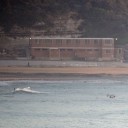
Already warm as the sun came over the horizon this morning. Heading to 36 along the coast and 41 inland, so there will be lots of folks jockeying for parking spots at the beach today. Doesn’t look as though there will be anything much in the waves department though. Sets at North Narrabeen and at Dee Why centre were struggling to make much above the knee high mark. We are talking tiny as it gets before you have to admit that it’s f-l-a-t.
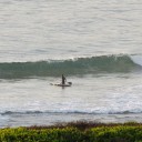
According to the MHL buoy, the day started off in Sydney with about a metre of 8 second period SE windswell. The wind is north to NW and will push around to the north about lunch time before getting around to the NE for the afternoon. When that happens we might get a slight pick up in wave energy – but I’m guessing it’ll go from knee to waist to maybe waist to chest at exposed spots – if we’re really lucky.
Tomorrow a south change is expected around about midday and the models are predicting a small upward bump in the energy levels, but again, I’m not expecting much, because the power levels are expected to be marginal.
A high pressure system over the central Tasman Sea is moving to the southeast maintaining a weak ridge to New South Wales north coast. A cold front will bring southerly to the far south coast this evening extending to the central coast Sunday afternoon an to the far north coast overnight. Behind the front another high pressure system is expected to move south of the Bight extending a ridge to the north coast.
Forecast for Saturday until midnight
Winds: North to northwesterly 10 to 15 knots becoming northerly 15 to 25 knots around midday then tending north to northeasterly up to 30 knots during the afternoon. Seas: Up to 1.5 metres increasing to 2 to 3 metres by early evening. Swell: Northeasterly 1 metre.Forecast for Sunday
Winds: West to northwesterly 10 to 20 knots tending northwest to southwesterly 10 to 15 knots during the morning ahead of a southerly change 10 to 20 knots around midday. Winds tending south to southeasterly and increasing to 20 to 30 knots during the afternoon. Seas: Up to 1.5 metres increasing to 3 metres by early evening. Swell: Northeasterly 1 metre. The chance of thunderstorms during the afternoon.Forecast for Monday
Winds: Southeasterly 20 to 25 knots decreasing to 15 to 20 knots during the morning then decreasing to 10 to 15 knots during the afternoon. Seas: Up to 3 metres decreasing to below 1 metre during the afternoon. Swell: Southerly about 1.5 metres.