Hello Friends,
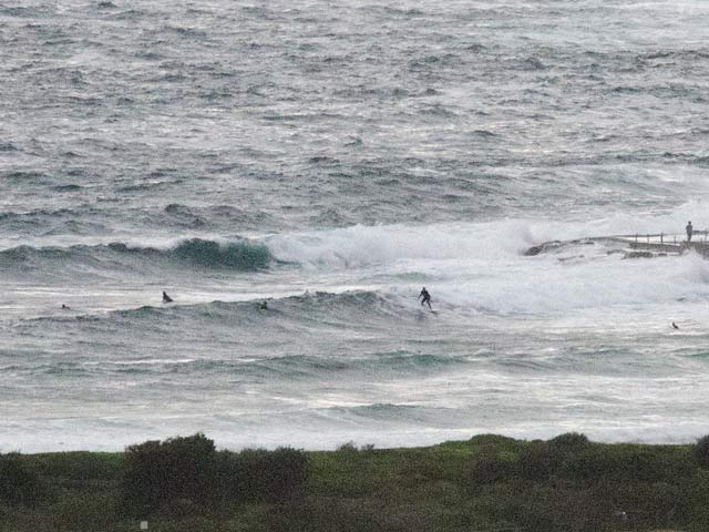
Another messy and junky day with steady SE wind from early. Swell’s around 2 metres at 9 seconds apart and is coming from pretty much the same direction as the wind. Dee Why point was entertaining a few punters even so. Sets looked to be in the chest high plus range and while pretty chaotic looking, it was clear that you could catch something if you tried.
Have yourself a great day!
Tides: H @0820, L @1450
Weather Situation
A high pressure system is moving south of the Bight gradually extending a ridge to New South Wales north coast. On Friday a trough is expected to develop near the coast with a low possibly developing near the south coast during Saturday or Sunday.
Forecast for Wednesday until midnight
- Winds
- East to southeasterly 10 to 20 knots.
- Seas
- Below 1 metre.
- Swell
- Easterly 1.5 metres.
Thursday 9 February
- Winds
- Easterly 15 to 20 knots.
- Seas
- 1 to 1.5 metres.
- Swell
- Southeasterly 1.5 metres.
Friday 10 February
- Winds
-
Easterly 10 to 15 knots.
- Seas
-
Below 1 metre.
- Swell
-
Southeasterly about 1.5 metres.
Forecast for the rest of Wednesday
- Summary

- Max 24
- Shower or two.
- Chance of any rain: 70%

- Rainfall amount: 2 to 6 mm
Sydney area
Cloudy. Isolated showers. Winds south to southeasterly averaging up to 20 km/h tending easterly and light by early evening.
Fire Danger – Low-Moderate
UV Alert from 9:10 am to 5:10 pm, UV Index predicted to reach 12 [Extreme]

