
Hello Friends,
Swell has dropped a fair amount from yesterday’s peak intensity, but it’s not exactly tiny. If you’re a beginner or even a tentative intermediate, sit and watch for half an hour before committing. The direction (SE) and average period (10sec) haven’t changed much, but average height at sea is closer to 2-3 m than yesterday’s 3-5 m. The Bureau still has a caution for large and powerful surf conditions though.
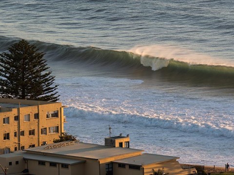
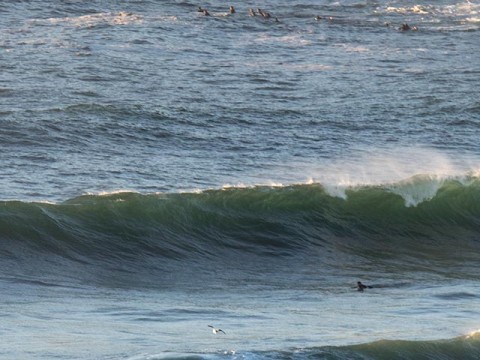
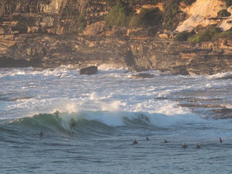
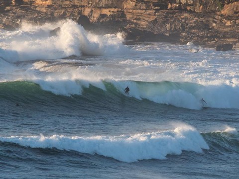
The Narrabeen stretch was just one long line shutting down, so with that off the table, crowd pressure will be up elsewhere. Dee Why point had a healthy population at first light and there were even a few hardy types looking for something catchable in the beach break. Set wave faces were in the chest to a touch overhead range, but it would surprise me if there weren’t still the odd double-overhead bomb in the mix this morning.
Wind was light offshore for the early risers. It’s going to be SW again, but not as strong as yesterday, so again, that should be a good thing for many spots.
Tide was high at 0645 and will be back to low at 1330.
Swell should continue its gradual fade over the next 24 hours, but it’s not looking like droppimg back into the tiny range for awhile yet. The real problem is that were due to go back into another extended period of southerly wind conditions. It’s set to swing south this afternoon and then stay that way through to the middle of the week at least. Tomorrow morning could be okay though because it should be only light for the early session. Mind you, that high tide will introduce its own complications.
I’m planning to get out and about with the camera, so if you see me, wave hello! Have a great day and know your limits.
Weather Situation
A low centred to the east of Bass Strait is the dominant weather system in the region, directing a generally southerly airstream along the New South Wales coast. This low will remain slow-moving today as a high passes to its south, maintaining large swells and vigorous winds, especially in southern waters. Later tonight and on Sunday the low is expected to weaken and move away to the east, with a new high south of the Bight building a ridge along the New South Wales coast.
Forecast for Saturday until midnight
Winds
Southwesterly 10 to 15 knots, reaching up to 20 knots offshore in the morning. Winds turning southerly in the early afternoon.
Seas
1.5 to 2 metres, decreasing to 1 to 1.5 metres during the morning.
Swell
Southerly 2 to 3 metres.
Weather
Mostly sunny. 20% chance of a shower.
Caution
Large and powerful surf conditions are expected to be hazardous for coastal activities such as crossing bars by boat and rock fishing.
Sunday 1 February
Winds
Southerly about 10 knots increasing to 10 to 15 knots in the middle of the day.
Seas
Below 1 metre.
Swell
Southerly 2 to 2.5 metres.
Weather
Partly cloudy. 40% chance of showers.
Monday 2 February
Winds
Southerly 15 to 20 knots.
Seas
1 to 1.5 metres.
Swell
Southerly 1.5 to 2 metres.
Weather
Partly cloudy. 60% chance of showers.

