
Hello Friends,
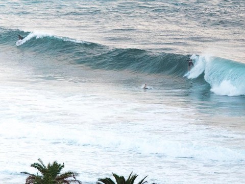
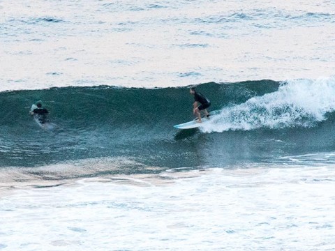
Plenty of surf options this morning as long as you aren’t too picky. We have close to 2 metres of 10-sec ESE swell and light winds early. Wind is set to come up from the NE but it looks like it might be okay all morning. Surface a bit textured and given the low tide at 1015 or so, it’s not surprising that things are a little shutty-downy in the beachies. Wave faces are in the chest to head high range on the bigger ones.
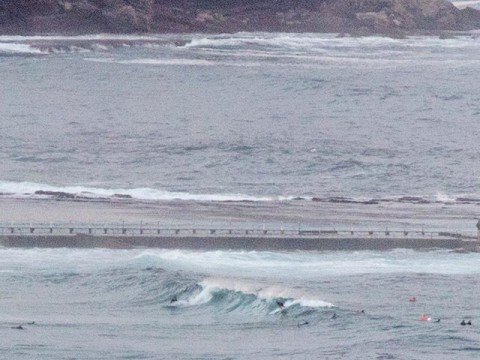
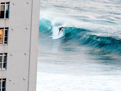
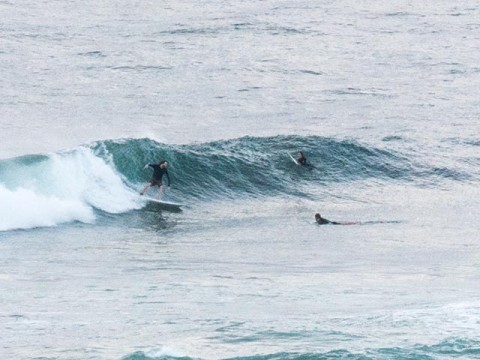
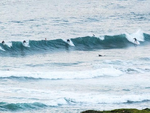
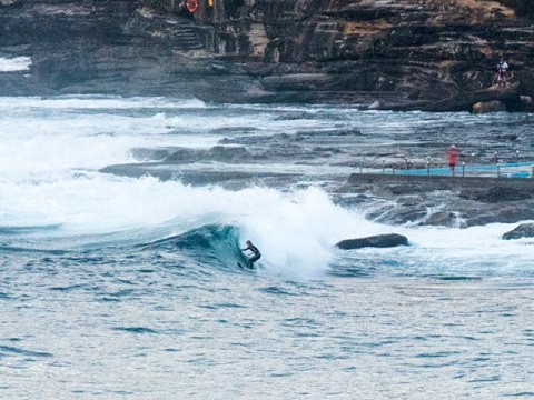
Had a good look around because it’s radio report day and at 0630 the crew were well and truly on it at Northy. Looked reasonably consistent up there and set wave faces were in the shoulder plus range on bombs. Coming down the beach there were a few little knots of surfers hanging on inconsistent and sometimes crunchy peaks. Nothing too focused, but as usual, the most activity was in the vicinity of the Marquesas. Around the corner there were waves all along the Longy to Dee Why stretch. Waves were in the waist to chest range with the odd slightly bigger one and there were distinct peaks at the life guard tower, the lugga, No Man’s and just north of the club. Not super busy, but busy enough to require a modicum of patience. The point had its hopefuls but it seemed to be smaller and much less consistent than the rest of the joint.
Outlook is for the energy to back off a little tomorrow and then we face the prospect of marginal, but not flat short period NE wind swell with more or less unremitting NE wind for the next week. The models indicate longer period (10 sec or so) more east to NE stuff in the 1.5 metre range from about Thursday.
So, not a fabulous outlook, but there should be reason to get in the water at some point and some place most days.
Have yourself a great Valentine’s day one and all.
Weather Situation
A strong high centred west of New Zealand extends a ridge to the northwest, and is directing generally east to northeasterly winds along the New South Wales north coast. The high is expected to move very slowly over the southern Tasman Sea during the weekend and be centred over New Zealand early next week. A weak trough lies over southern New South Wales. A front will approach from the west late in the weekend, reaching the southwest of the state on Sunday and the far south coast on Monday.
Forecast for Saturday until midnight
- Winds
- Northeasterly about 10 knots increasing to 10 to 15 knots in the middle of the day. Winds reaching up to 20 knots inshore in the late evening.
- Seas
- Around 1 metre.
- Swell
- Easterly 1.5 metres.
- Weather
- Partly cloudy. 60% chance of showers. The chance of a thunderstorm.
Sunday 15 February
- Winds
- Northeasterly 15 to 20 knots.
- Seas
- 1 to 1.5 metres, decreasing to 1 metre during the morning, then increasing to 1.5 metres during the afternoon.
- Swell
- Easterly 1 to 1.5 metres, decreasing to around 1 metre by early evening.
- Weather
- Partly cloudy. 70% chance of showers. The chance of a thunderstorm.
Monday 16 February
- Winds
- Northeasterly 15 to 20 knots.
- Seas
- 1 to 1.5 metres.
- Swell
- Easterly around 1 metre.
- Weather
- Mostly sunny. 30% chance of a shower.
