
Hello Friends,
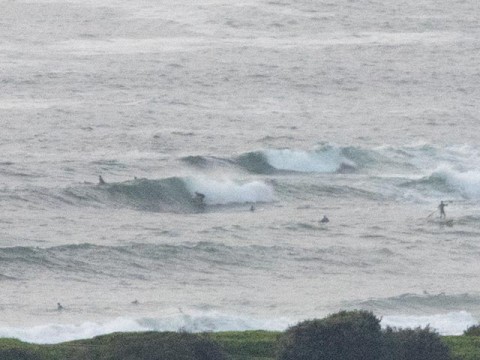
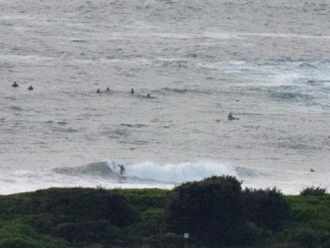
The 0500 MHL directional spectra chart for Sydney was showing 1.9 metres of 9-second E-ENE energy. Two hours later when your servant climbed aloft for a squizz at Dee Why it was, as the pictures show, around the chest mark on sets. Wind was very light so the surface was smooth, if lumpy. Wave quality was so-so. That is there were a few sections of interest, but rides were generally brief.
Marcia is way too far away for us to see any sort of effect this far down the coast. Indeed, the Bureau says the swell will back off a little today as it moves more NE.
Tide’s high at 0920 and back to low at 1545 and beachwatch says our water temp is a balmy 24.
Looking at the Coastalwatch cam for snapper there’s size up that way but it looks pretty lumpy despite the favourable wind early. So, we’re not really missing out down this way.
The Goat’s call from yesterday is lining up well with the more conservative of the models. At the other end of the spectrum, there are some predictions pointing to sizable east (3+ metres @ 10s) for Mon-Tue with lightish winds for the early…
Once again, apologies to those of you getting a red warning page from Google. There really isn’t an issue now because we’ve shut the attackers’ door, but until the big G rescans our site, they’re still flagging us as evil doers. I’ve not heard about anyone being hit with malware during the attack which is a good sign too. Hope this will all have blown over in the next day or so.
Have yourself a fine old Friday one and all and just stay happy!
Weather Situation
A slow-moving high pressure system near New Zealand extends a ridge to the northwest and is directing east to northeasterly winds along the New South Wales coast. while Tropical Cyclone Marcia over the Coral Sea is moving south-southwest. The cyclone will cross the central Queensland coast this morning and is expected to bring strong to gale force winds along the New South Wales north coast.
Forecast for Friday until midnight
- Winds
- Northeasterly 10 to 15 knots tending northerly in the late evening.
- Seas
- Below 1 metre, increasing to 1 to 1.5 metres offshore during the afternoon.
- Swell
- Easterly 1.5 to 2 metres, decreasing to 1.5 metres around midday, then tending northeasterly 1.5 metres by early evening.
- Weather
- Partly cloudy. 80% chance of showers.
Saturday 21 February
- Winds
- North to northeasterly 10 to 15 knots becoming east to northeasterly below 10 knots in the middle of the day then increasing to 10 to 15 knots in the early afternoon.
- Seas
- Around 1 metre.
- Swell
- Northeasterly 1.5 to 2 metres, tending easterly 1.5 to 2 metres during the morning, then decreasing to 1.5 metres around midday.
- Weather
- Cloudy. 50% chance of showers.
Sunday 22 February
- Winds
- Northeasterly 10 to 15 knots turning easterly 15 to 20 knots during the morning.
- Seas
- Around 1 metre, increasing to 1 to 1.5 metres offshore during the afternoon or evening.
- Swell
- Easterly 1.5 metres, increasing to 1.5 to 2 metres offshore.
- Weather
- Partly cloudy. 40% chance of showers.
