
Hello Friends,
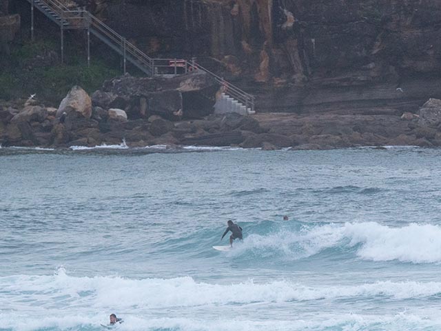
It’s not flat and it’s not blown out. Tide’s coming in off the low at 0630 and there was 1.6 metres of ENE swell at 9 seconds when the Sydney MHL buoy last communicated at 0500. And yet Dee Why was not interesting enough to attract any surfers when I checked at 0730. As the pictures show, it’s pretty small – maybe knee to waist at best – along the beach. And the point was smaller still. So, it should, technically be possible to catch something marginal.
Wind was out of the NE at 6-8 kts and will be picking up into the 10-15 kt range later.
0900:
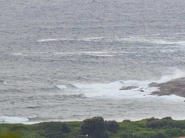
Had a Manly run this morning so got a look at there and Curly. Manly was pretty messy and junky, but there were folks out chasing waist to chest stuff. Curly was about the same size but junkier at the south end and cleaner at the north.
Outlook is for wave heights to stay at around the current size today, to be down a touch tomorrow and to stay that way through Thursday. Some of the models are projecting a small increase in the average period from Friday morning through Saturday. If I had to pick a day in the coming week, it’d be Friday morning at east swell spots.
Have a great Monday everyone!
Tides: L @0630, H @1240, L @1850
Weather Situation
A slow-moving high pressure system near New Zealand extends a ridge toward southeast New South Wales and is directing northeasterly winds along the New South Wales south and central coasts. A low pressure system (Ex- Tropical Cyclone Marcia), located off the southeast Queensland coast is moving east to northeast and weakening. A trough extending from this low toward the Coral Sea is expected to remain for the next few days. A front passing through New South Wales is expected to reach the far south coast late on Monday or early Tuesday. This front is expected to reach central parts of the coast before weakening later on Tuesday.
Forecast for Monday until midnight
- Winds
- Easterly 10 to 15 knots turning northeasterly in the afternoon.
- Seas
- Around 1 metre, increasing to 1 to 1.5 metres offshore.
- Swell
- Easterly 2 metres.
- Weather
- Partly cloudy. 80% chance of showers.
Tuesday 24 February
- Winds
- East to northeasterly about 10 knots becoming south to southeasterly in the morning. Winds reaching up to 20 knots inshore during the afternoon and evening.
- Seas
- Below 1 metre, increasing to 1 to 1.5 metres inshore during the afternoon.
- Swell
- Easterly 1.5 metres, increasing to 1.5 to 2 metres offshore.
- Weather
- Partly cloudy. 60% chance of showers.
Wednesday 25 February
- Winds
- South to southeasterly 10 to 15 knots.
- Seas
- Around 1 metre.
- Swell
- Easterly 1 to 1.5 metres.
- Weather
- Partly cloudy. 40% chance of showers

