
Hello Friends,
It may have been smooth when I first looked at it this morning around 0750, but southerly was on its way and the Bureau has hoisted the strong wind warning for 20-30 kts of southerly this morning.
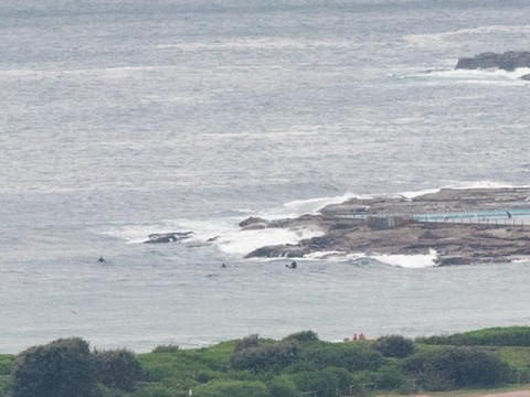
Swell is a barely there little ripple out of the east. It’s right on the metre mark at sea and the average period is 9 seconds. There were several hopefuls at the point and dotted along the beach, but in the time I watched, no one caught a wave. I’d say you’d be doing well to get a thigh high bump at a magnet spot. And when the wind kicks in… so… what else is on?
Outlook is for the wind to stay southerly through tomorrow and then to be light on Tuesday morning. At the same time, the swell models are still predicting some long period east energy for us from around Monday afternoon to Tuesday midday. Thereafter the period is predicted to drop back gradually and with it the surf prospects. If they’re right, the models say it’ll be micro by week’s end and then beyond that we seem to be facing the prospect of not much…
Ah well, we’re getting closer to the wave season…
Have a top old Sunday everyone.
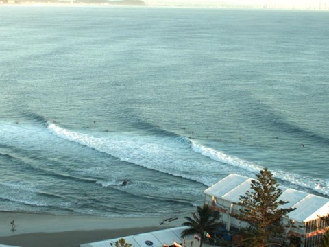
ps: Looks busy but very fun up at superbank this morning – judging by the WRL cam. Here’s a grab…
Weather Situation
A strong cold front is moving north along the NSW coast, with strong southerly winds behind it. A high is expected to be centred over Tasmania tonight in the wake of the front before moving to the southern Tasman Sea on Monday. A trough of low pressure and associated cold front is expected to affect the far south on Tuesday.
Forecast for Sunday until midnight
Strong Wind Warning for Sunday for Sydney Coast
- Winds
- Northwesterly 10 to 15 knots, shifting southerly 20 to 30 knots in the morning.
- Seas
- Below 1 metre, increasing to 2 to 3 metres during the morning.
- Swell
- East to southeasterly around 1 metre.
- Weather
- Partly cloudy. 90% chance of showers. A thunderstorm likely during the day.
Monday 16 March
- Winds
- Southerly 15 to 20 knots, reaching up to 25 knots offshore early in the morning. Winds turning east to southeasterly below 10 knots in the evening.
- Seas
- 1.5 to 2 metres, decreasing to 1 metre during the morning.
- Swell
- East to southeasterly 1 to 1.5 metres, tending southerly 1.5 to 2 metres during the morning, then decreasing to 1.5 metres around midday.
- Weather
- Cloudy. 60% chance of showers.
Tuesday 17 March
- Winds
- Variable about 10 knots becoming northeasterly 15 to 25 knots during the afternoon.
- Seas
- Below 1 metre, increasing to 1 to 1.5 metres during the afternoon or evening.
- Swell
- Southeasterly 1.5 metres, tending easterly 1 to 1.5 metres during the morning.
- Weather
- Partly cloudy. 20% chance of a shower.

