
Hello Friends,
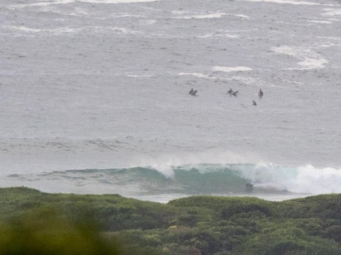
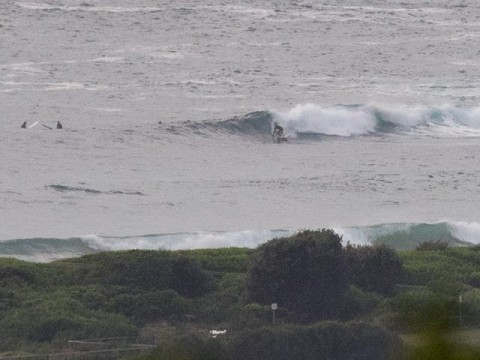
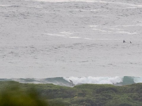
Again, very fat on the high tide for the modest morning crew at Dee Why beach and the point. The MHL buoy showed 1.5 metres of east swell at 12 seconds apart. It was a long wait between catchable ones at Dee Why when I first checked this morning. Set wave faces were in the waist to chest range at both the point and along the beach. Surface conditions were smooth though.
Wind was NE by 0800 and the Bureau says it’s going to build up into the 15-20kt range before fading back this evening. They also say that we should see easterly swell of 1.5-2 metres today, but it will fade overnight and be 1-1.5 metres from the NE tomorrow morning and then about a metre on Friday morning ahead of an afternoon south change.
Not looking real wonderful for the weekend. Right now it seems we can expect plenty of SE wind and a small SE wind bump for Saturday and then equally steady east wind on Sunday with equally marginal east wind bump.
The long range models are all looking very quiet for our corner of the world next week. If they’ve got it right, the best we can hope for will be little knee to waist high dribblers in the mornings.
Have yourself a great Wednesday and good luck with the wave hunt.
Tides: H @0715. L @1345
Weather Situation
A high pressure ridge lies over the Tasman Sea, while a trough extends through inland New South Wales. Between these systems, north to northeasterly winds will be fresh to strong in most coastal areas today, before the trough brings a southerly change to the southern coast during the evening. The trough is expected to decay in the north during Thursday, with many areas seeing a return to northerly winds as a feeble high pressure system drifts across from the west. Another, stronger, trough and associated southerly change is forecast to affect the coast during Friday and Saturday.
Forecast for Wednesday until midnight
Winds
North to northeasterly 15 to 20 knots, reaching 25 knots offshore, tending east to northeasterly around 10 knots in the evening.
Seas
1.5 to 2 metres, decreasing to 1 to 1.5 metres during the evening.
Swell
Easterly 1.5 to 2 metres tending northeasterly by evening.
Weather
Partly cloudy. 40% chance of showers. The chance of a thunderstorm.
Thursday 19 March
Winds
South to southwesterly 15 to 20 knots, shifting east to northeasterly 10 to 15 knots in the late afternoon and evening.
Seas
1 to 1.5 metres.
Swell
Northeasterly 1.5 to 2 metres, decreasing to 1 to 1.5 metres during the morning.
Weather
Mostly sunny.
Friday 20 March
Winds
Northerly 10 to 15 knots shifting southerly 15 to 25 knots during the afternoon.
Seas
Around 1 metre, increasing to 1.5 to 2.5 metres during the afternoon.
Swell
Northeasterly around 1 metre.
Weather
Becoming cloudy. 40% chance of showers. The chance of a thunderstorm.
