
Hello Friends,
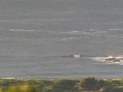
Rainy afternoon coming up, but the sun was putting in an appearance as the day got started. But a great slab of cloud was sliding slowly in from the south as I climbed aloft to grab the morning snap. As you can see, it was extremely small at 0730 – but not absolutely flat. Several SUP’ers were poking around for the odd ankle to knee high little NE lines at the Dee Why end of the beach.
Swell was about a metre out of the NE at just 5 seconds apart. Glorified wind chop really, but it was glassy looking, so with the right equipment some low key fun could ensue. East swell magnets should be producing a touch more size on the biggest ones, but I reckon the bombs won’t get much above waist high.
Wind is lightly SSW as of 0800 but is expected to swing south to SE soon before going back to the SW this evening. Tomorrow the wind is supposed to come up a fair amount from the south to SW but it doesn’t look like mattering much/ The models aren’t too hopeful for Wednesday or Thursday, but some are predicting a mix of SSW swell with 10+ sec average periods and some sub-metre east swell of about the same period. Bottom line? Maybe some waist to chest plus energy at places where the mix comes together optimally. The Bureau reckons the wind will be out of the SW until noon Friday, so… here’s hoping!
And… the models say we could still have some energy for Saturday…
Have yourself a fine old Tuesday!
Tides: L @0620, H @1225
Weather Situation
A high pressure system over the southern Tasman Sea is moving east maintaining a ridge to the New South Wales north coast. During Tuesday a cold front will bring a southerly change to southern and central parts of the coast before weakening in the north on Wednesday. The next front with an associated southerly change is expected to move up the coast during Thursday and Friday.
Forecast for Tuesday until midnight
- Winds
- North to northwesterly 10 to 15 knots, reaching up to 20 knots offshore in the morning. Winds shifting south to southeasterly later in the morning then tending south to southwesterly in the evening.
- Seas
- 1 to 2 metres, decreasing below 1 metre during the morning.
- Swell
- East to northeasterly around 1 metre.
- Weather
- Partly cloudy. 90% chance of rain. The chance of a thunderstorm during this afternoon and evening.
Wednesday 25 March
Strong Wind Warning for Wednesday for Sydney Coast
- Winds
- South to southwesterly 15 to 25 knots, reaching up to 30 knots offshore early in the morning. Winds shifting east to northeasterly 10 to 15 knots in the evening.
- Seas
- 1 to 2 metres decreasing below 1 metre in the afternoon.
- 1st Swell
- South to southeasterly 1 to 1.5 metres.
- 2nd Swell
- Easterly around 1 metre.
- Weather
- Partly cloudy. 40% chance of showers in the morning.
Thursday 26 March
- Winds
- North to northeasterly 10 to 15 knots shifting southwesterly and increasing to 20 to 30 knots during the evening.
- Seas
- Around 1 to 1.5 metres.
- Swell
- Southerly 1 to 1.5 metres.
- Weather
- Partly cloudy. 40% chance of showers.
