
Hello Friends,
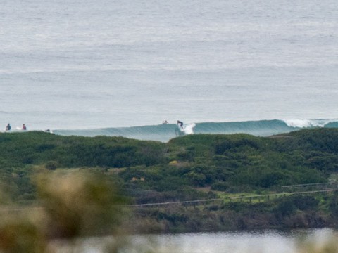
Grey skies, a light offshore breeze and a clean waist high SE line this morning at Dee Why beach. The point has gone flat and on current trends, the beach will likely be in the same state in the next 24-48 hours. If the models are correct, we’ll be dealing with flatness or near enough through to Thursday when our next south pulse should develop.
Our high tide will be at 0815 and it’ll be back to low at 1405.
Looks like the plan is to get out there asap, or be prepared to sit it out until the end of the week.
Have yourself a great Monday one and all!
…
Weather Situation
A strong high pressure system over the Tasman Sea extends a ridge over eastern NSW. A low and associated cold front will approach NSW tomorrow tomorrow with winds tending northwest to northerly and freshening, the front will bring a southwest to southerly change on the south coast later Wednesday.
Forecast for Monday until midnight
Winds
Southwest to southeasterly about 10 knots tending east to northeasterly 10 to 15 knots in the afternoon.
Seas
Below 1 metre.
Swell
South to southeasterly 1 to 1.5 metres, decreasing to around 1 metre during the morning.
Weather
Cloudy. 50% chance of showers.
Tuesday 19 May
Winds
Northwesterly 10 to 15 knots turning northerly 15 to 20 knots in the morning.
Seas
Below 1 metre, increasing to around 1 metre during the morning, then increasing to 1 to 1.5 metres by early evening.
Swell
South to southeasterly around 1 metre.
Weather
Partly cloudy. 40% chance of rain. The chance of a thunderstorm offshore in the morning.
Wednesday 20 May
Winds
Northwesterly 15 to 20 knots.
Seas
1 to 1.5 metres.
Swell
Northeasterly below 1 metre.
Weather
Becoming
cloudy. 40% chance of rain. The chance of a thunderstorm

