
Hello Friends,
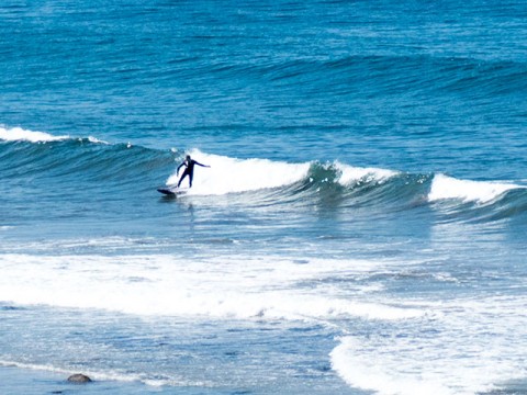
Through a fog of jet lag, your correspondent can report that surf conditions between LA and Ventura were not wildly dissimilar to what your’re seeing in Sydney today. Although there were healthy crowds at places like Malibu and California Street in Ventura, wave faces were in the knee to waist (at best) range. There’s a nice line though, which meant that if you didn’t mind rail-bumping business at Malibu, you could definitely get the odd slide.
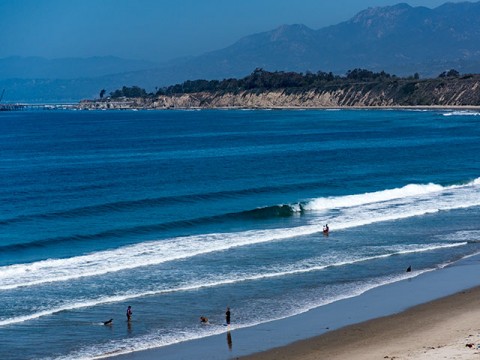
Today’s postcards come from the lookout near Rincon’s top carpark. Although the point is pretty much an autumn-winter spot, there can be some interesting peaks up the beach to the north in the right conditions. When there’s a steeply angled south swell (say from a hurricane off Mexico), backside Rincon can come into play too.
.
.
Outlook for Sydney is not too brilliant. The MHL buoy was detecting less than a metre of 11-sec SE swell as of 0700. Wind was light offshore but a southerly’s due through around midday and when that hits I’d expect things to really fall apart surfwise.
The swell prediction models are pointing to some hope of an improvement next week, but right now the tomorrow and the weekend are not looking too interesting.
That’s it from me for now, will try to file postcards etc as regularly during my stay here. Have yourself a great day!
Weather Situation
A front will bring south to southwesterly change to Sydney Waters this morning and to the north coast in the afternoon. Southerly winds are expected to turn east to southeasterly during Friday and Saturday as a high pressure system moves over southeastern Australia extending a ridge to the Tasman Sea.
Forecast for Thursday until midnight
Winds
Westerly below 10 knots tending southwesterly 15 to 20 knots in the morning then tending southerly 15 to 25 knots in the middle of the day.
Seas
Below 1 metre, increasing to 1 to 1.5 metres during the morning, then increasing to 1.5 to 2.5 metres around midday.
1st Swell
South to southeasterly around 1 metre.
2nd Swell
Easterly around 1 metre.
Weather
Cloudy. 80% chance of showers. The chance of a thunderstorm offshore during the morning and afternoon.
Friday 26 June
Winds
Southerly 15 to 20 knots, reaching up to 25 knots offshore early in the morning. Winds tending southeasterly 10 to 15 knots in the middle of the day.
Seas
1.5 to 2 metres, decreasing to 1 metre during the morning.
1st Swell
South to southeasterly around 1 metre.
2nd Swell
Easterly around 1 metre.
Weather
Partly cloudy. 30% chance of a shower.
Saturday 27 June
Winds
Southeasterly 10 to 15 knots becoming variable about 10 knots during the morning.
Seas
Below 1 metre.
Swell
Southerly around 1 metre.
Weather
Partly cloudy. 20% chance of a shower.
