Hello Friends,
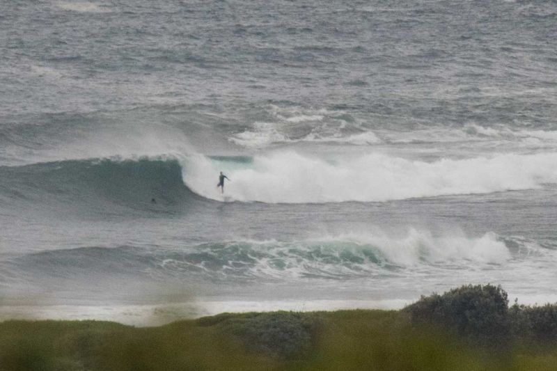
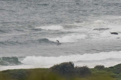
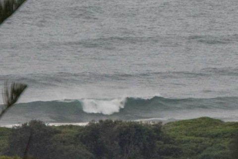
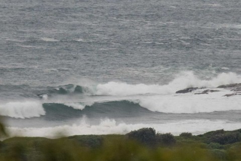
The Bureau tells us it expects the swell to pulse up a little in the middle of the day. Given that there were overhead sets every now and again around 0700, it could get interesting. The day started out with more gloomy skies but very little wind. At 0400 the MHL buoy was picking up a mix of south and NE swell energy. The strongest stuff was coming from the south but there is some low, long period swell from the NE. At Dee Why these settings were producing waist to occasionally overhead waves at the point and along the beach. Only a few folks in the water at the former and no one I could see at the latter. Schools are going back this week, so maybe that’s a factor.
Tide is running into the high just before noon and the light winds meant conditions were smooth but some what lumpy from yesterday’s wind.
Speaking of the wind, the Bureau tells us to expect the NE’r to picky up soon and to be 15-20 kts when it gets going.
I’ll be interested to see what the Goat thinks about the coming week’s prospects. My reading of the models this morning is that we’re probably looking at the best of it today and that it’ll be more marginal as the weekend arrives. And I wonder if he’ll have anything to say about late next week…
Have yourself a top old Thursday everyone!

Weather Situation
A high pressure system to the southeast of Tasmania is moving slowly east maintaining a ridge to the north, directing southeast to northeasterly winds along the New South Wales coast. Winds will turn north to northeasterly during today and as the ridge weakens and a low pressure trough approaches from the west. This trough is expected to evolve into a complex low pressure system as it reaches the coast at the end of the week, with several centres likely to develop. There is considerable uncertainty regarding the position of these centres, which will have a significant influence on wind speed and direction.
Forecast for Thursday until midnight
Winds
Northeasterly 15 to 20 knots, reaching up to 25 knots offshore in the late evening.
Seas
1 to 1.5 metres, increasing to 1.5 to 2 metres offshore.
Swell
Easterly around 1 metre, increasing to 1 to 1.5 metres during the morning, then decreasing to around 1 metre by early evening.
Weather
Cloudy. 80% chance of showers. The chance of a thunderstorm later tonight.
Caution
Deceptively powerful surf conditions are expected to be hazardous for coastal activities such as crossing bars by boat and rock fishing.
Friday 29 January
Winds
Northerly 15 to 25 knots turning northeasterly 20 to 25 knots in the morning.
Seas
1 to 2 metres, decreasing to 1 to 1.5 metres during the morning, then increasing to 2 metres around midday.
Swell
Easterly around 1 metre, increasing to 1 to 1.5 metres offshore.
Weather
Partly cloudy. 70% chance of showers. The chance of a thunderstorm.
Saturday 30 January
Winds
North to northeasterly 15 to 25 knots shifting southwesterly 15 to 20 knots during the evening.
Seas
1 to 2 metres, decreasing to 1 metre during the morning.
Swell
Easterly around 1 metre, increasing to 1.5 to 2 metres during the morning.
Weather
Partly cloudy. 60% chance of showers. The chance of a thunderstorm.

