
Hello Friends,
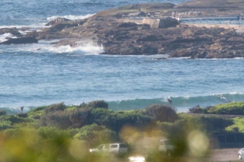
Another warm and sunny summer Sunday. Wave energy has slipped down another notch and as of 0800 it looked pretty marginal at Dee Why from the RealSurf crows nest.
Wind was lightly out of the north and the 0600 report from the MHL buoy was showing about a metre of six second period NE wind chop. People were in the water, but it looked as though wave faces were struggling to be much above knee high. Tide was low at 0740 and will be back to high at 1345. By that point in the day we can expect the wind to be 15-20 kts from the south to SE.
Once the wind is around to the southern quarters, the forecast tells us that it’ll stay there basically until Thursday morning when it’s forecast to be lightly offshore before going to the NE.
As the wind goes to the south on Monday, the swell models tell us that the dominant swell will start coming at us from east for a couple of days before getting back to a southerly dominated regime on Wednesday.
Should be an interesting few days, particularly at spots that can cope with south wind. At this stage I’m picking Thursday morning as the most likely to be the day…
Have yourself a great Sunday one and all and keep on smilin’!

Weather Situation
A high pressure system near New Zealand extends a ridge to the New South Wales north coast, maintaining east to southeasterly winds near the Queensland border. Northeasterly winds along southern and central parts of the coast will shift southerly today with the passage of a trough. The trough is expected to stall around Seal Rocks early Monday before a cold front brings a second, stronger southerly change to the entire coast on Tuesday. Meanwhile, Tropical Cyclone Tatiana over the Coral Sea is forecast to track southwards during the next day or two, potentially generating a large swell over northern New South Wales waters early in the week.
Forecast for Sunday until midnight
Winds
Northerly 15 to 20 knots shifting south to southeasterly during the afternoon and evening.
Seas
1 to 1.5 metres.
Swell
Easterly below 1 metre.
Weather
Sunny.
Monday 15 February
Winds
South to southeasterly 10 to 15 knots, reaching 25 knots inshore at first, shifting north to northeasterly in the afternoon.
Seas
1 to 2 metres.
1st Swell
Southerly around 1 metre.
2nd Swell
Easterly around 1 metre.
Weather
Partly cloudy. 60% chance of showers. The chance of a thunderstorm.
Tuesday 16 February
Winds
Southwesterly 15 to 20 knots turning southerly during the morning.
Seas
Below 1 metre, increasing to 1 to 2 metres during the morning.
1st Swell
Southerly around 1 metre, increasing to 1 to 1.5 metres offshore during the afternoon or evening.
2nd Swell
Easterly around 1 metre.
Weather
Partly cloudy. 60% chance of showers. The chance of a thunderstorm in the morning and afternoon.
Please be aware
Wind gusts can be 40 percent stronger than the averages given here, and maximum waves may be up to twice the height.
Nearby Coastal WatersThis forecast is also available via scheduled broadcasts on marine radio.
Latest Coastal Observations
Tide Predictions
The next routine forecast will be issued at 4:05 pm EDT Sunday.
Product IDN11009

