
Hello Friends,
Pictures tell the story this morning. Surface conditions were nice and smooth under hazy skies. Low tide’s at 0850 and the wind was lightly offshore to start. It’s going to warm up to 29 and possibly that will see a thunderstorm here and there. Wind is due to get around to the SE then to move on to NE later.
The MHL buoy was picking up 1.4 metres of 6-sec south wind bump as of 0500.
Outlook is for not much change on the surf front today.
0930 update
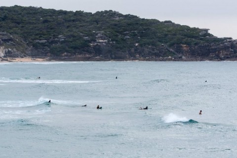
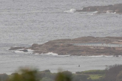
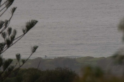
Did the Manly run this morning and can report the unsurprising news that it’s puny everywhere. Still, it’s glassy and if you have a mal or similar, there are some little sliders about.
Outlook is much the same as yesterday’s call. Small today, then the gradual appearance of longer period east swell starts to make itself from tomorrow. Unfortunately the wind outlook remains ordinary – basically southerlies in the 15-20 kt range through to Wednesday night is the call. But Thursday is still looking very promising, particularly the morning when the wind forecast is looking friendly indeed and the swell could be pretty impressive. Currently the models are showing around 3 metres from the south at about 12 sec. Could be good…
Have a great Monday!

Earlier…
Weather Situation
A high pressure system near New Zealand extends a ridge towards northeast New South Wales, while southerly change on the southern and central coasts has stalled in the vicinity of Seal Rocks, and will weaken during the day. A deepening low to the south of Tasmania is forecast to move east during the next day or two, with an associated cold front bringing a more vigorous southerly change to the southern New South Wales coast tonight, extending through central and northern waters on Tuesday. A high pressure ridge should become established over the state’s east in the wake of this front, with winds gradually shifting more northerly again during the second half of the week.
Forecast for Monday until midnight
Winds
Southeasterly 10 to 15 knots turning east to northeasterly 15 to 20 knots during the morning.
Seas
1 to 1.5 metres.
Swell
Easterly 1 to 1.5 metres.
Weather
Partly cloudy. 30% chance of a shower. The chance of a thunderstorm this afternoon.
Tuesday 16 February
Winds
North to northwesterly 10 to 15 knots shifting southerly 15 to 25 knots before dawn.
Seas
1 to 1.5 metres, increasing to 1.5 to 2 metres during the morning.
1st Swell
Southerly around 1 metre, increasing to 1 to 2 metres by evening.
2nd Swell
Northeasterly 1 to 1.5 metres.
Weather
Mostly sunny. 70% chance of showers. The chance of a thunderstorm in the morning.
Wednesday 17 February
Winds
Southerly 20 to 30 knots.
Seas
1.5 to 2.5 metres, decreasing to 1 to 1.5 metres during the afternoon.
1st Swell
Southerly 1.5 to 2 metres, increasing to 2 to 3 metres during the morning.
2nd Swell
Easterly around 1 metre.
Weather
Partly cloudy. 20% chance of a shower.
Please be aware
Wind gusts can be 40 percent stronger than the averages given here, and maximum waves may be up to twice the height.
Nearby Coastal Waters

