Hello Friends,
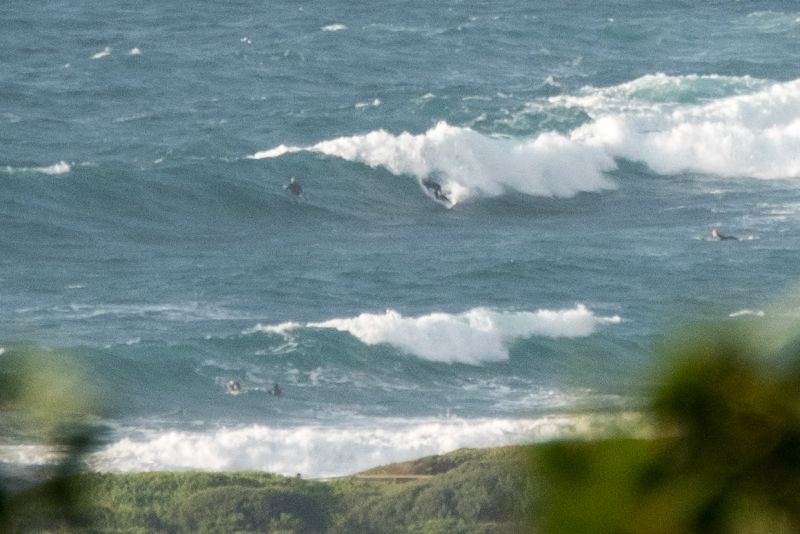
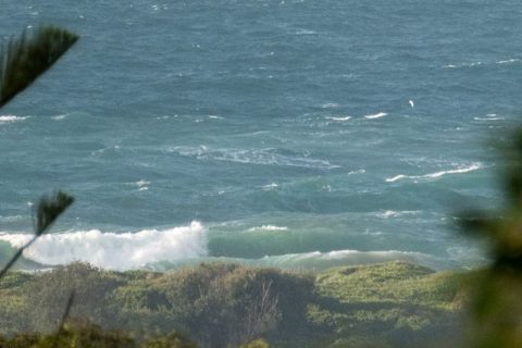
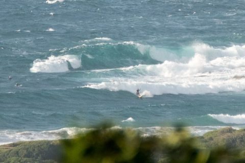
As expected, this morning sees 15-20 kts of SE wind smashing up 2.3 metres of 8-second SE swell. There were a few bods thrashing around in the chaos off the point at Dee Why and a few inside amongst the shorey craziness. Wave faces on the biggest ones were overhead. Tide’s heading to the high at 0930 as I write this and it looked as though skies were clearing in line with the forecast.
Wind is set to stay around the same strength and direction all day and I’d guess the swell will only weaken a bit. As long as you don’t mind very messy onshore conditions, there should be a wave of sorts at many places. But as the pics show, you’ll want to be keen. Beachwatch has question marks over water quality at Collaroy and from Curly south. Bronte to Coogee’s the same and ditto for north Cronulla to Sandshoes.
Tomorrow looks like more SE wind, but down a bit, so maybe there’s a slight hope for slightly cleaner in the early morning, but the swell will have dialled back a touch. Tuesday seems more hopeful again, with the models and the Bureau agreeing that wind will be lightly onshore early, going NE later and swell should still be in the fun range (chest with plusses) thanks to a mix of east and south energy.
Have yourself a great Sunday one and all!

Weather Situation
A strong high over south-eastern Australia is moving slowly east, with a low near Lord Howe Island also moving east. This pattern is generating south to south-easterly winds along the NSW coast, with an area of strong winds over the northern half. Winds will decrease during Monday, and tend northeasterly over the southern parts of the coast, as the high gradually moves into the Tasman Sea.
Forecast for Sunday until midnight
Winds
Southeasterly 15 to 20 knots, reaching up to 25 knots offshore during the morning.
Seas
1.5 to 2 metres, decreasing to 1 to 1.5 metres around midday.
Swell
Southeasterly 2 to 2.5 metres.
Weather
Partly cloudy. 40% chance of showers this morning.
Monday 25 April
Winds
Southeasterly 10 to 15 knots.
Seas
Around 1 metre.
Swell
Southerly 1.5 metres, increasing to 1.5 to 2 metres offshore.
Weather
Partly cloudy.
Tuesday 26 April
Winds
East to northeasterly about 10 knots increasing to 10 to 15 knots during the afternoon then becoming north to northeasterly about 10 knots during the evening.
Seas
Below 1 metre.
1st Swell
Southerly 1 to 1.5 metres, decreasing to around 1 metre during the afternoon.
2nd Swell
Easterly around 1 metre.
Weather
Partly cloudy. 30% chance of a shower.
Please be aware
Wind gusts can be 40 percent stronger than the averages given here, and maximum waves may be up to twice the height.
Nearby Coastal Waters

