
Hello Friends,
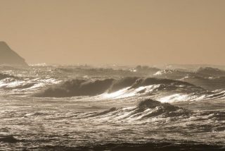
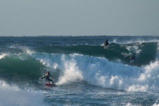
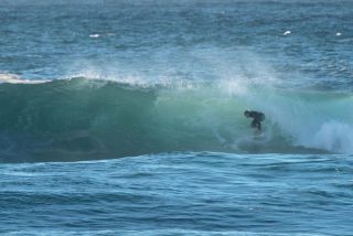
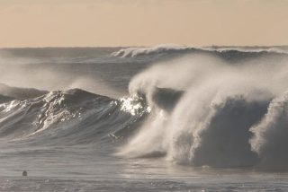
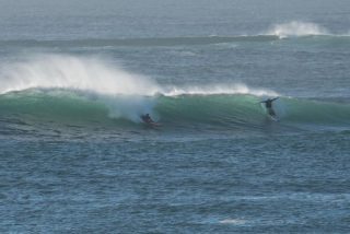
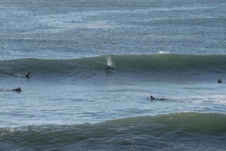
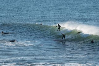
On a schedule this morning, so just gonna get the pics up and maybe come back later for more thoughts (and pictures even). Swell’s close to 3 metres from the SSE and 10-11sec apart but looking pretty raw at the exposed spots like Dee Why.
later!
.
.
.
.
.
.
Weather Situation
A high pressure system over the state is moving east slowly, prompting a gradual easing of the southwest flow over the waters and establishing northeast to northwest winds. During Thursday a trough will move through Bass Strait with northwesterly winds freshening before a south to southwesterly change extends along southern parts of the coast. The change will then extend to central parts on Friday as the low reaches the southern Tasman Sea.
Forecast for Wednesday until midnight
- Winds
- West to southwesterly 10 to 15 knots becoming variable about 10 knots in the early afternoon then becoming northwesterly 10 to 15 knots in the late evening.
- Seas
- 1 to 1.5 metres, decreasing to 1 metre during the morning.
- Swell
- Southerly 3 to 5 metres, decreasing to 2.5 to 3 metres by early evening.
- Weather
- Mostly sunny.
- Caution
- Large and powerful surf conditions are expected to be hazardous for coastal activities such as crossing bars by boat and rock fishing.
Thursday 26 May
Strong Wind Warning for Thursday for Sydney Coast
- Winds
- Northwesterly 15 to 25 knots, reaching up to 30 knots during the day. Winds turning westerly 20 to 25 knots in the late afternoon.
- Seas
- Around 1 metre, increasing to 1.5 to 2.5 metres offshore.
- Swell
- Southerly 2 to 2.5 metres, decreasing to 1 to 1.5 metres around midday.
- Weather
- Cloudy. 60% chance of showers.
Friday 27 May
- Winds
- Westerly 20 to 30 knots.
- Seas
- 1 to 2 metres, increasing to 2 to 3 metres offshore.
- Swell
- Southerly around 1 metre, increasing to 1.5 to 2.5 metres during the morning.
- Weather
- Mostly sunny. 20% chance of a shower.

