
Hello Friends,
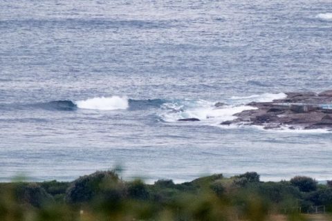
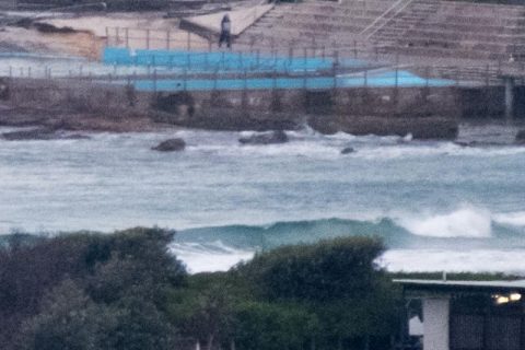
Cloudy with a 90% prospect of more rain later as the day got started. Dee Why point was empty and I couldn’t see anyone in the water along the bits of the beach I can see from the crowsnest. Wind was light and from the west and a metre or so of swell was coming from the SE with a wind swelly 7 second period. Tide was high at 0420 and is heading to the low at 1040. I reckon you might find a waist high little bump at a better exposed location, but it’s likely to be pretty gutless thanks to that short period. Plus, the Bureau’s calling for it to decrease across the morning before coming up a bit again overnight into tomorrow.
Most of the swell models are pointing toward an improvement in the period setting along with the uptick in size from around tomorrow afternoon. Friday looks ho-hum on most of the predictions and Saturday morning is similar, but from Saturday afternoon all the predictions are indicating a dramatic rise in the swell. It’s supposed to be rainy Saturday but on Sunday as the swell is predicted to go into the nutty range (3-4 metres), the weather should improve and the wind should play nice too. On current reckoning, Monday could be the peak day, but it could be pumping all next week at south spots. Wind predictions look good too… basically lots of winter offshores.
Will try to add another pic or two later, so in the meantime, have yourself a productive and happy day!
.
.
Weather Situation
A high pressure system near Tasmania extends a ridge into New South Wales while a trough lies over the coast. The high is expected to move slowly east across the Tasman Sea during the next few days. Winds are likely turn northeasterly and increase during Saturday as the trough deepens, with winds shifting westerly later in the weekend when the trough becomes mobile moves east over the Tasman Sea.
Forecast for Wednesday until midnight
Winds
South to southeasterly 10 to 15 knots easing to about 10 knots in the early afternoon.
Seas
Below 1 metre.
Swell
Southeasterly 1.5 metres, decreasing to around 1 metre during the morning, then increasing to 1 to 1.5 metres by early evening.
Weather
Cloudy. 80% chance of showers. The chance of a thunderstorm.
Thursday 2 June
Winds
East to northeasterly about 10 knots tending south to southwesterly 10 to 15 knots before dawn. Winds reaching up to 20 knots offshore in the late afternoon.
Seas
Around 1 metre, increasing to 1 to 1.5 metres during the afternoon, then decreasing below 1 metre later in the evening.
Swell
Southeasterly 1.5 metres, increasing to 1.5 to 2 metres offshore.
Weather
Cloudy. 90% chance of showers. The chance of a thunderstorm offshore.
Friday 3 June
Winds
Variable about 10 knots becoming northeasterly 15 to 20 knots during the evening.
Seas
Below 1 metre, increasing to 1 to 1.5 metres offshore during the evening.
1st Swell
Southeasterly 1 to 1.5 metres.
2nd Swell
Easterly around 1 metre.
Weather
Cloudy. 70% chance of showers

