
Hello Friends,
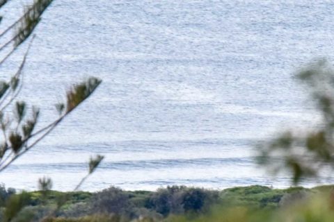
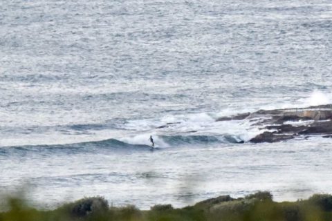
Light NNW wind and swell coming from the SSW as Wednesday got underway along the beaches. In the middle of the night the MHL buoy was showing close to 2 metres at 11 seconds, but the swell angle and the wind are combining to keep the energy away from us. That said, there was a person hanging out at the point a little after 0700 when I grabbed the pics and they did catch a little waist high bump that ran a respectable distance. Up the beach you could see the lines in the ocean, but I’d be surprised if it was any bigger than the point on the sets. Tide’s heading into the high at 0930.
The Bureau’s call is for the wind to be strong again today but it’ll be coming from the west to NW, so there is that.
The models are still showing not much of interest until Saturday. If anything, they project a further weakening of energy levels between now and then.
Saturday currently looks interesting on many of the models. Swell’s expected to be coming from the south at 3 metres at around 10-12 seconds along with WSW wind in the 20-30kt range. Should be sunny as well. It looks like Sunday will be smaller but still above the 2 metre mark, plus the wind should be lighter and still offshore. With luck it’ll stay that way into Monday…
Have yourself a top old Wednesday one and all and keep on smilin’!
.
.
Weather Situation
A low pressure system over the southwest Tasman Sea is forecast to move southeast. This low is generating fresh to strong westerly winds over New South Wales waters. Winds are expected to ease today as the low moves further away from New South Wales. Winds will shift northwesterly and strengthen on Thursday ahead of a cold front which is likely to cross southern waters on Friday.
Forecast for Wednesday until midnight
Strong Wind Warning for Wednesday for Sydney Coast
Winds
West to northwesterly 20 to 25 knots, reaching up to 30 knots offshore during the morning.
Seas
1 to 1.5 metres, increasing to 2 to 3 metres offshore.
Swell
Southerly 1 to 1.5 metres.
Weather
Mostly sunny. 20% chance of a shower offshore this morning. Near zero chance of rain elsewhere.
Thursday 23 June
Winds
Westerly 15 to 20 knots turning northwesterly during the morning. Reaching up to 25 knots offshore in the late evening.
Seas
1 to 2 metres.
Swell
Southerly 1 to 1.5 metres.
Weather
Partly cloudy. 30% chance of a shower offshore in the evening. Near zero chance of rain elsewhere.
Friday 24 June
Winds
Northwesterly 20 to 30 knots turning west to southwesterly 30 to 35 knots during the afternoon.
Seas
2 to 3 metres, increasing to 2.5 to 4 metres during the afternoon or evening.
Swell
Southerly below 1 metre.
Weather
Partly cloudy. 40% chance of showers. The chance of a thunderstorm in the evening.

