Hello Friends,
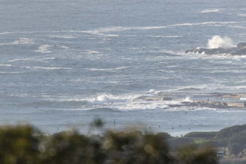
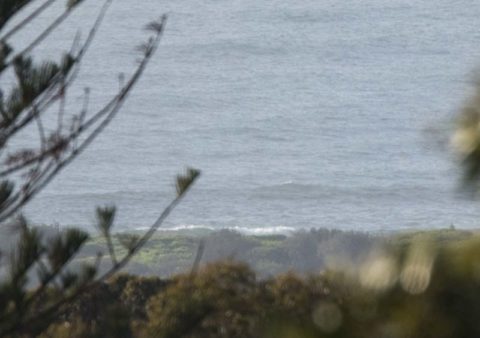
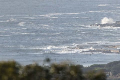
As of 0700 the wind was light from the north and there was around 1.5 metres of 6-7 sec east wind bump struggling against the incoming tide (high’s at 0850). There were a fair number of bods in the water at Kiddies waiting for the odd knee to waist bump.
We’re headed for a windy and warm day says the Bureau. They’re calling for a high of 28 and the wind that was light early is expected to give way to 20-30kts of N-NE soon. So we can expect some scrappy chest plusses maybe late this afternoon at spots that strike the balance between the wind direction and the wind swell that’ll get pushed up.
Tomorrow looks dicey on the wind front and only slightly hopeful for swell. Basically it looks like whipsawing from north at 20-30 to S-SW to NE to SE. I’m not too confident that it’ll be very surfable at all – too many changes of direction and no real sign of longer period swell. Just looks like local wind bump.
The models are joyless for the rest of the work week and into the weekend. Looks like typical spring conditions of near flat to barely catchable for the most part. Ah well, it is spring after all, so we’ll take what fun we can find.
Speaking of fun, have yourself a fun old Sunday and keep on smilin’!
Weather Situation
North to northeasterly winds will strengthen today ahead of a cold front moving across New South Wales. A south to southwesterly change will move northwards along the New South Wales coast from late on Sunday and during Monday as the front moves through. After the front clears the state on Monday, a ridge of high pressure will become established across southeast Australia.
Forecast for Sunday until midnight
Strong Wind Warning for Sunday for Sydney Coast
Winds
North to northeasterly 20 to 25 knots increasing to 20 to 30 knots in the morning.
Seas
1.5 to 2 metres, increasing to 2 to 3 metres during the morning.
Swell
Northeasterly around 1 metre, increasing to 1 to 1.5 metres offshore around midday.
Weather
Partly cloudy. 70% chance of rain and the chance of a thunderstorm this afternoon and evening.
Monday 31 October
Strong Wind Warning for Monday for Sydney Coast
Winds
North to northwesterly 15 to 25 knots, reaching up to 30 knots during the morning. Winds shifting south to southwesterly 20 to 30 knots early in the morning then tending southeast to northeasterly 10 to 15 knots in the afternoon.
Seas
2 to 3 metres, decreasing to 1 metre during the afternoon.
1st Swell
Southerly 1 to 1.5 metres.
2nd Swell
Northeasterly 1 to 1.5 metres.
Weather
Mostly sunny. 20% chance of a shower and the chance of a thunderstorm offshore in the early morning.
Tuesday 1 November
Winds
Northwest to southwesterly 10 to 15 knots tending north to northeasterly 15 to 20 knots during the morning then tending north to northwesterly during the evening.
Seas
Below 1 metre.
Swell
Southerly 1 to 2 metres.
Weather
Cloudy. 50% chance of showers. The chance of a thunderstorm.

