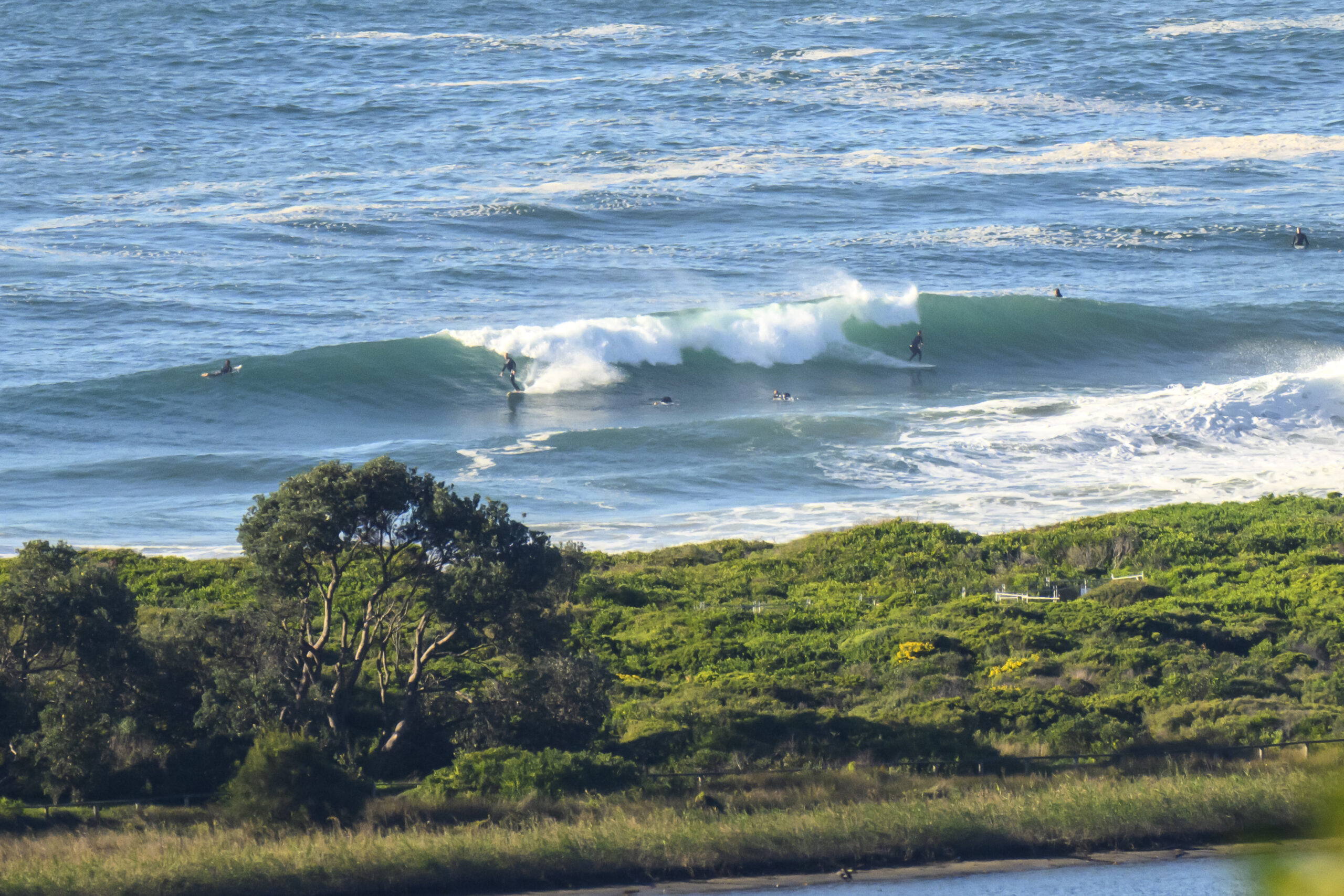
Surf forecast issued Thursday 29 December 2016: Seven day outlook for Sydney:
The surf should be going down from today’s conditions, but there should still be enough movement in the ocean over the next several days, to get cool and to have fun in the water, along with everyone else!
Friday: down in the 1-2 metre range North East… that means bigger at southern ends of beaches than at northern ends
Saturday: ditto East North East
Sunday New Year’s Day: about 1 metre or so East North East
Monday: coming up in the 1-2 metre range at places that like dead South swell.. and bypassing most other places
Tuesday: down a little in ditto
Wednesday: ditto and ditto
Thursday: about 1 metre dead South
And in a two for the price of one deal for you… here’s free of charge, gratis, and gratuitous:
TG’s New Year Message
Well, 2016 went by as fast as this year’s winning yachts in the Sydney-Hobart … and that was quick!
Lots of fun things happened and some less than fun things happened at the personal, local, and world levels over the past twelve months for us all I’m sure, or at least I hope the net result was mostly positive for everyone’s memory banks. If not, then c’est la vie for 2016, and let’s hope for a better 2017!
What’s in store for 2017?? Who knows for sure. But some things are for certain for the coming year…
The world will keep turning, the sun will come up each day (even if obscured by clouds from time to time), the winds will keep blowing, and waves will keep on rolling onto beaches around the world. Let’s hope we can all catch plenty of them.
Stay well, stay safe in and out of the surf and have fun!
Happy New Year.
TG.
The Air

Winds
https://www.windytv.com/?-33.903,151.152,6
The Sea
Water temp is around 21 offshore, but as was anticipated in last week’s post the nearshore temp has dropped to freezing according to a sample of users. The reason for the difference as explained on the MHL website is
“Local currents and other oceanographic phenomena, such as upwelling of cooler water from deeper offshore, can influence the sea temperature at the shoreline.”
Or, blame the the howling Noreasters. And add to that, the contrast with the warmish air temp. .

Tides
http://www.rms.nsw.gov.au/documents/maritime/usingwaterways/tides-weather/tide-tables-2016-2017.pdf
Weather from the Bureau:
Sydney Forecast
View the current warnings for New South Wales
Forecast issued at 4:24 pm EDT on Thursday 29 December 2016.
Forecast for the rest of Thursday
- Summary

- Partly cloudy.
- Chance of any rain: 0%

Sydney area
Partly cloudy. Winds east to northeasterly 15 to 25 km/h becoming light in the late evening.
Sun protection recommended from 8:30 am to 5:30 pm, UV Index predicted to reach 16 [Extreme]
Friday 30 December
- Summary

- Min 24
- Max 35
- Hot. Shower or two.
- Possible rainfall: 0 to 1 mm
- Chance of any rain: 60%

Sydney area
Hot. Cloudy. Medium (60%) chance of showers, most likely in the afternoon and evening. The chance of a thunderstorm. Light winds becoming north to northwesterly 15 to 25 km/h in the middle of the day then tending north to northeasterly 15 to 20 km/h in the evening.
Fire Danger – Very High
Sun protection recommended from 8:40 am to 5:30 pm, UV Index predicted to reach 16 [Extreme]
7 day Town Forecasts
| Precis Icon | Location | Min | Max |
|---|---|---|---|
| Sydney | 24 | 35 | |
| Penrith | 25 | 39 | |
| Liverpool | 23 | 38 | |
| Terrey Hills | 22 | 35 | |
| Richmond | 24 | 39 | |
| Parramatta | 23 | 38 | |
| Campbelltown | 22 | 38 | |
| Bondi | 24 | 31 |
Saturday 31 December
- Summary

- Min 24
- Max 28
- Shower or two clearing.
- Possible rainfall: 0 to 1 mm
- Chance of any rain: 60%

Sydney area
Partly cloudy. Medium (60%) chance of showers, most likely in the early morning. The chance of a thunderstorm in the west in the early afternoon. Light winds becoming south to southeasterly 20 to 30 km/h in the morning then tending east to southeasterly 15 to 20 km/h in the early afternoon.
Sun protection recommended from 8:50 am to 5:30 pm, UV Index predicted to reach 15 [Extreme]
Sunday 1 January
- Summary

- Min 23
- Max 28
- Showers.
- Possible rainfall: 1 to 3 mm
- Chance of any rain: 80%

Sydney area
Cloudy. High (80%) chance of showers. Light winds becoming southerly 25 to 35 km/h during the evening.
Sun protection recommended from 8:40 am to 5:30 pm, UV Index predicted to reach 16 [Extreme]
Monday 2 January
- Summary

- Min 21
- Max 25
- Shower or two.
- Possible rainfall: 0 to 2 mm
- Chance of any rain: 50%

Sydney area
Cloudy. Medium (60%) chance of showers. Winds south to southwesterly 15 to 25 km/h turning southeasterly during the morning.
Tuesday 3 January
- Summary

- Min 20
- Max 25
- Shower or two.
- Possible rainfall: 0 to 2 mm
- Chance of any rain: 50%

Sydney area
Cloudy. Medium (60%) chance of showers. Light winds becoming east to southeasterly 15 to 20 km/h during the day.
Wednesday 4 January
- Summary

- Min 20
- Max 24
- Shower or two.
- Possible rainfall: 0 to 2 mm
- Chance of any rain: 50%

Sydney area
Cloudy. Medium (60%) chance of showers. Light winds.
Thursday 5 January
- Summary

- Min 20
- Max 26
- Showers.
- Possible rainfall: 3 to 10 mm
- Chance of any rain: 80%

Sydney area
Cloudy. High (80%) chance of showers. Light winds becoming easterly 15 to 20 km/h during the day.

