
Hello Friends,
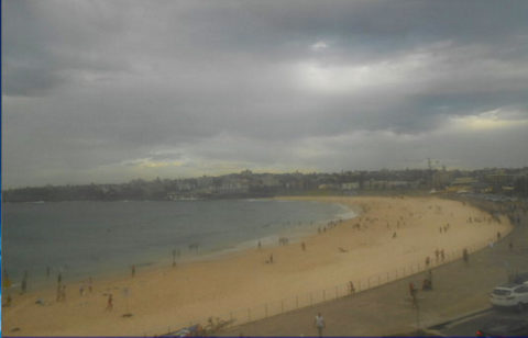
As the screengrab from North Bondi RSL’s cam shows, there’s no energy coming from the south this morning. The MHL Sydney buoy was showing 1.4 metres of 7-sec NE wind bump a couple of hours ago and from the look of the cams I’d say you can expect ankle to knee with the possible waist high bomb at spots well tuned to the lightweight swell conditions.
We had a 1.56m high at 0645, so the run out won’t be adding any energy to the already paltry offerings.
Could be a small bump from the south tomorrow, but the wind’ll be on top of it and the models are mostly saying waist high at best for magnets. Midweek currently is shaping to be dire. There’s a slight hope for a tiny improvement across the weekend, but right now there doesn’t seem to be anything of real interest beyond that.
Meanwhile in SoCal
After dropping yesterday, supposedly there’s another brief pulse headed toward us for later today. Wind is still a factor at exposed spots, but we’re starting to get a few sunny breaks. The ocean looks like chocolate milk from all the run-off out of the hills and the swell is still raw and chaotic looking most places. Not many people in the water. Not sure if I’ll have a postcard for you later today… but check back around mid-arvo to see…
Have a great day!
Weather Situation
A high over the Tasman Sea is directing northeast to northwesterly winds over New South Wales waters ahead of a trough that will bring a southerly change to southern and central parts of the coast today, before stalling around the north coast on Wednesday. Another high is expected to move over the Tasman Sea by Friday, turning winds east to northeasterly for the weekend.
Forecast for Tuesday until midnight
Strong Wind Warning for Tuesday for Sydney Coast
Winds
Northeast to northwesterly 15 to 25 knots, reaching 30 knots at times ahead of a gusty southerly change 25 to 30 knots during the late afternoon. Winds easing to 20 to 25 knots by the late evening.
Seas
2 to 3 metres, decreasing to 1 to 1.5 metres during the afternoon, then increasing to 1.5 to 2.5 metres by early evening.
1st Swell
Southeasterly around 1 metre.
2nd Swell
East to northeasterly around 1 metre.
Weather
Becoming cloudy. 90% chance of showers. The chance of a thunderstorm during this afternoon and early evening.
Wednesday 25 January
Winds
South to southeasterly 15 to 20 knots turning easterly 10 to 15 knots in the middle of the day.
Seas
1.5 to 2.5 metres, decreasing below 1 metre during the morning.
1st Swell
Southerly below 0.5 metres, increasing to 1 to 2 metres during the morning, then decreasing to 1.5 metres around midday.
2nd Swell
Northeasterly around 1 metre.
Weather
Cloudy. 30% chance of a shower in the early morning.
Thursday 26 January
Winds
Easterly 10 to 15 knots turning south to southeasterly 15 to 20 knots during the morning.
Seas
Around 1 metre, increasing to 1 to 1.5 metres during the afternoon.
Swell
Southerly 1 to 1.5 metres, decreasing to around 1 metre during the morning.
Weather
Cloudy. 60% chance of showers


