
Hello Friends,
At 0540 wind was WSW 15-20 kts at North Head and the MHL buoy’s latest update was showing 1.6 metres of 6-sec SE wind bump. Put those together and you have… a good reason to sleep in.
The Bureau’s forecast is calling for the wind to swing south and for wave heights to improve as a combo SE and NE wind swell fills in. But looking at the various models, I’m not overly hopeful on your behalf. I reckon it’ll be south-torn mostly micro wind dribble myself.
The way I read it, the prospects are for really tiny to flat conditions until Wednesday late when there seems to be a prospect for slightly longer period stuff filling in from the east. Thursday-Friday have some potential for east magnets – at least at this stage.
I was off the air yesterday because normally dry Santa Barbara copped an absolute bucketing (numerous single day rainfall records broken) and there was no power for us until late in the evening.
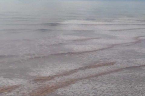
This morning the cams are showing messy conditions with an ocean that looks like chocolate milk from the tremendous amount of run-off.
Weather Situation
A high pressure system near New Zealand extends a ridge to the northwest directing north to northeasterly winds along the New South Wales north coast while a slow moving low pressure trough is bringing southerly change along the south and central coasts. On Sunday a low will form within the trough off the central coast before moving rapidly to the south during Monday. Winds are expected to turn southeast to northeasterly during Tuesday as another high pressure system moves over the southern Tasman Sea behind the low extending a ridge to the north coast.
Forecast for Sunday until midnight
Strong Wind Warning for Sunday for Sydney Coast
Winds
Southerly 15 to 25 knots, reaching up to 30 knots early in the morning. Winds becoming variable about 10 knots in the evening.
Seas
2 to 3 metres, decreasing to 1 metre during the afternoon.
1st Swell
Southerly around 1 metre, increasing to 1 to 1.5 metres offshore during the morning.
2nd Swell
Northeasterly around 1 metre, increasing to 1 to 1.5 metres offshore.
Weather
Cloudy. 80% chance of showers offshore, 60% chance elsewhere.
Monday 20 February
Winds
West to southwesterly 15 to 20 knots, reaching up to 25 knots offshore early in the morning. Winds becoming variable about 10 knots in the early afternoon then becoming easterly 10 to 15 knots in the evening.
Seas
1 to 2 metres.
1st Swell
Southerly around 1 metre, increasing to 1 to 1.5 metres offshore during the afternoon.
2nd Swell
Northeasterly around 1 metre.
Weather
Sunny.
Tuesday 21 February
Winds
East to northeasterly 10 to 15 knots tending north to northeasterly during the morning then tending east to northeasterly during the day.
Seas
Below 1 metre.
Swell
Southerly around 1 metre, increasing to 1 to 1.5 metres offshore.
Weather
Mostly sunny. 30% chance of a shower.
