
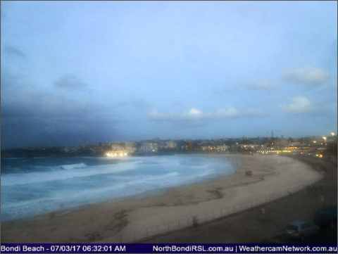
The marine forecast tells the tale: across the next three days the south swell’s going to be big enough to trigger dangerous surf warnings and the wind’s going to be southerly and probably not going to drop below the 15-20 kt range. As I write this a little after 0600, the wind’s 10-15 kts at North Head but 20-25 kts at the much more exposed Little Bay. Could be the odd shower about as well. From the early morning cams, it looks raw, stormy and grey everywhere. I suppose there might be the odd waist plus at Collaroy…
The MHL buoy hasn’t reported in since yesterday afternoon when it was 4 metre, 10-sec south swell. If the models are right, it won’t be fading noticeably until late in the week. And some predictions have it actually ramping up a bit on Friday – which could be good if the wind goes more SW. It basically looks like lots of wind and swell this week and then a decline to smaller for next week.
Santa Barbara’s winter swell prospects have dimmed with the warming weather. Right now it looks like I’ll be lucky to get in the water this week. And next week doesn’t look any better. So, no fresh postcards I’m afraid.
Weather Situation
A low pressure system off the coast is gradually moving eastward. This will generate strong south to southwesterly winds over most of the NSW coast during the next day or two, as well as large and powerful surf conditions. Winds will moderate and gradually turn south to southeasterly during today and Wednesday as the low moves over to the northeastern Tasman Sea and a high pressure system near Tasmania extends a ridge to the NSW coast.
Forecast for Tuesday until midnight
Strong Wind Warning for Tuesday for Sydney Coast
Winds
Southerly 20 to 30 knots.
Seas
2.5 to 3 metres.
Swell
Southerly 2.5 metres, tending southeasterly 2.5 to 3 metres during the morning.
Weather
Cloudy. 40% chance of showers.
Caution
Large and powerful surf conditions are expected to be hazardous for coastal activities such as crossing bars by boat and rock fishing.
Wednesday 8 March
Winds
Southerly 15 to 20 knots turning southeasterly in the evening.
Seas
1.5 to 2.5 metres, decreasing to 1.5 metres around midday.
Swell
Southeasterly 2.5 to 3 metres.
Weather
Cloudy. 60% chance of showers.
Caution
Large and powerful surf conditions are expected to be hazardous for coastal activities such as crossing bars by boat and rock fishing.
Thursday 9 March
Winds
Southerly 20 to 25 knots increasing to 25 to 30 knots during the afternoon.
Seas
1.5 metres, increasing to 2 to 2.5 metres during the morning.
Swell
Southeasterly 2.5 to 3 metres.
Weather
Cloudy. 50% chance of showers.
Caution
Large and powerful surf conditions are expected to be hazardous for coastal activities such as crossing bars by boat and rock fishing.

