
Hello Friends,
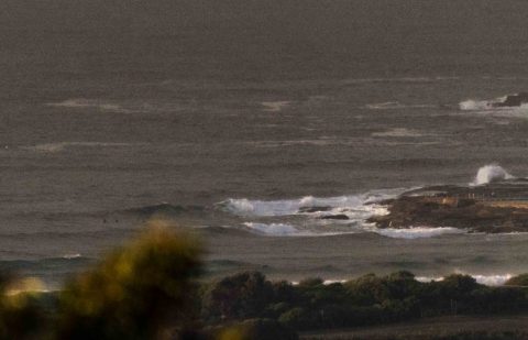
In a hurry this morning so just the one pic for now. A rain squall was coming in as I grabbed the picture, so I didn’t get a chance to really watch the conditions for long enough to form a solid impression of what’s going on. The main thing is that as of 0730, wind was still westerly. Swell is around 2 metres from the SSE but average period is only around the 8 second mark. Tide’s dropping to the low at 0940 and it’ll be back to a 1.6 metre high at 1605.
Weather Situation
A low pressure system lies well offshore over the central Tasman Sea while a large ridge of high pressure extends across southern New South Wales. The combination of these systems is directing south to southeasterly winds across New South Wales Waters. Stronger winds are expected for the northern half of the coast until Wednesday, when the low pressure system moves further away to the east. The high pressure ridge is expected to persist for the next several days.
Forecast for Monday until midnight
Winds
Southerly 15 to 20 knots turning southeasterly in the evening.
Seas
1.5 to 2 metres, decreasing to 1 to 1.5 metres during the morning.
1st Swell
Southeasterly 1 to 1.5 metres, increasing to 1 to 2 metres offshore.
2nd Swell
East to northeasterly around 1 metre.
Weather
Partly cloudy. 60% chance of showers.
Tuesday 20 June
Winds
Southeasterly 10 to 15 knots turning southerly during the morning and early afternoon.
Seas
Around 1 metre.
Swell
Southeasterly 1 to 1.5 metres, tending easterly 1 to 1.5 metres during the morning, then increasing to 1.5 to 2 metres during the afternoon.
Weather
Partly cloudy. 40% chance of light showers.
Wednesday 21 June
Winds
West to southwesterly 10 to 15 knots turning southerly during the morning.
Seas
Around 1 metre.
Swell
Easterly 1.5 to 2 metres.
Weather
Partly cloudy. 30% chance of a light shower.

