Hello Friends,
.
Let’s get the Sydney surf situation taken care of before the postcards…
At 0950 there was a light and steady 7-9 kt SSE breeze knocking the top off another day of gutless and tiny wind bump. That said, it does appear from the cams that it’s a touch bigger (ankle to waist) than when I last saw it. If you have to miss it, you aren’t missing much of anything. Judging from the forecast models, the situation should stumble along more or less as it is until Friday when there might be a little south pulse with NE wind combo.
The long range models are showing prospects for an intense south swell event, but it’ll likely be smashed by the wind (also south) for a couple days before possibly settling down into some fun conditions mid next week.
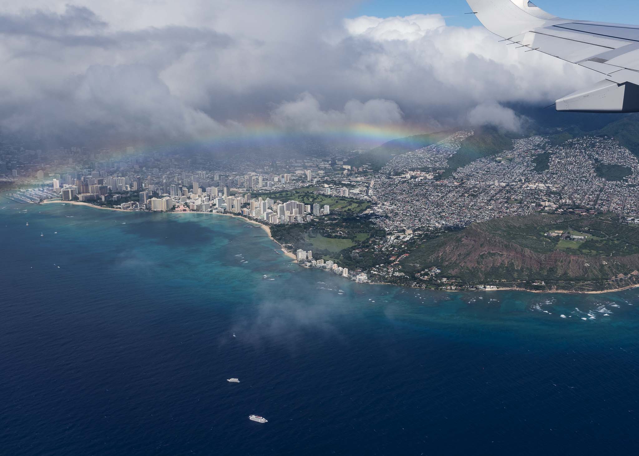
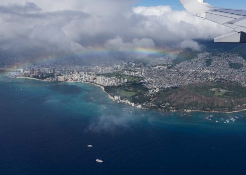
The flight from Oz to the US west coast involved a brief stop in Honolulu, so I can report that there was very little if anything showing on the town side. Did get a nice picture of Diamond Head and a rainbow as we climbed out again for the leg to LA.
Got into California after dark so didn’t get a look at the (non) surf situation until yesterday. No hope of a wave sadly. And the same again today (see below).
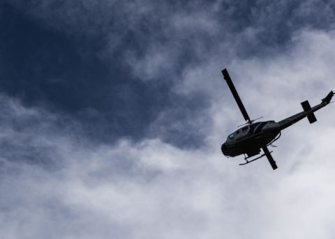
California had it’s first significant rain event in 300 days last night. We saw 75-100 mm and because of the terrible fires of a couple of weeks ago, there’s nothing on the hillsides to stop the water from carrying huge amounts of mud and debris down onto the coastal plain. As I write this the 101 Freeway that runs along the coast near where the fires were is still closed from all the stuff coming off the hills and mountains. It’s a really big deal and we’re still waiting to hear what sort of death toll there’s been. 8 people were killed by mudslides in the Montecito area just south of Santa Barbara – and there may be more. Helicopters have been flying over our place all day as they help with the rescue efforts. Scary stuff.
Hope you’re staying safe and well!
Weather Situation
A trough along the mid north coast is slowly moving northward, with northerly winds shifting southerly in its wake. The trough is expected to stall on the far north coast on Thursday and then dissipate, as a high pressure system moves east over the southern Tasman Sea and extends a ridge to the coast. This will cause winds to shift north to northeasterly throughout by Friday, freshening ahead of the next front, which will bring a vigorous southerly change to the coast during the weekend.
Forecast for Wednesday until midnight
- Winds
- Southerly 15 to 20 knots, reaching up to 25 knots offshore early in the morning. Winds tending southeasterly 10 to 15 knots in the early afternoon.
- Seas
- 2 metres, decreasing to 1.5 metres during the morning, then decreasing to 1 metre during the afternoon.
- Swell
- Southerly around 1 metre, increasing to 1 to 1.5 metres during the morning.
- Weather
- Cloudy.
Thursday 11 January
- Winds
- East to southeasterly below 10 knots tending east to northeasterly 10 to 15 knots in the early afternoon.
- Seas
- Below 1 metre.
- Swell
- Southerly 1 to 1.5 metres.
- Weather
- Partly cloudy.
Friday 12 January
- Winds
- Northeasterly 15 to 20 knots.
- Seas
- 1 to 1.5 metres.
- Swell
- Southeasterly 1 to 1.5 metres.
- Weather
- Partly cloudy.


