
Hello Friends,
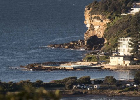
8-10 kts of NNW wind blowing out across a wine dark sea under largely cloudless skies as the sun came over the horizon and our Friday got underway. Out at sea MHL’s Sydney buoy was bobbing listlessly on a 9 second period 0.8 m SSE (158°) wind swell. Not that it mattered much, but tide was coming into a 1.52 m high at 0925. It’ll be back to a 0.43 m low at 1505. As the forecast below notes, the wind’ll pick up and go more westerly in the afternoon. But the swell will persist in its indolence.
So what’s ahead for us? Well, as he has for nigh on two decades, the Goat has cogitated on the prospects and produced his weekly outlook for our edification and planning.
Have yourself a great Friday one and all!
Weather Situation
A series of cold fronts are moving across the state today and the next few days, resulting in fresh west to northwesterly winds. Winds will tend south to southwesterly over the weekend as a low pressure system moves into the southern Tasman Sea and a high moves across the Bight.
Forecast for Friday until midnight
Strong Wind Warning for Friday for Sydney Coast
Winds
Northwesterly 20 to 25 knots turning westerly in the late afternoon. Winds reaching up to 30 knots offshore in the evening.
Seas
1 to 1.5 metres, increasing to 1.5 to 2.5 metres offshore.
Swell
Easterly below 1 metre.
Weather
Mostly sunny.
Saturday 16 June
Strong Wind Warning for Saturday for Sydney Coast
Winds
Westerly 20 to 25 knots, reaching up to 30 knots offshore in the evening.
Seas
1 to 2 metres, increasing to 1.5 to 2.5 metres during the afternoon.
Swell
Southerly below 1 metre.
Weather
Mostly sunny.
Sunday 17 June
Winds
Westerly 20 to 30 knots.
Seas
2 to 3 metres.
Swell
Southerly around 1 metre.
Weather
Mostly sunny.

