
Hello Friends,
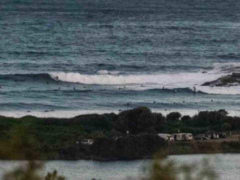
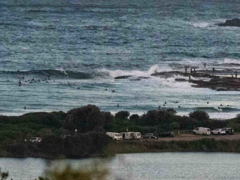
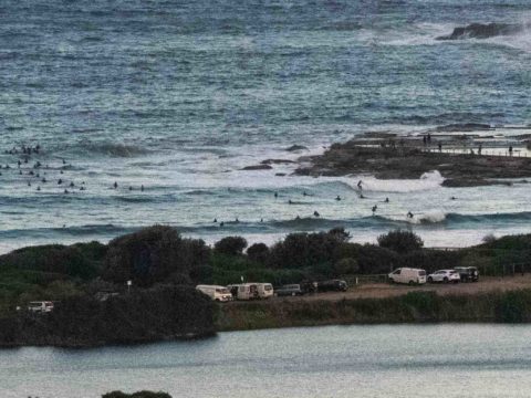
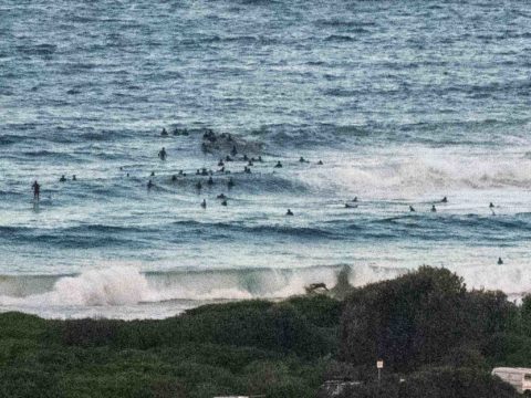
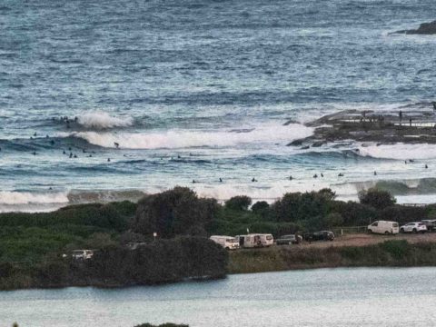
Cycled down to Manly for Hands Across the Sand action at south Steyne and so got a good look at the south pulse that had begun filling in late this morning. By the time I was looking at it around 1430-1600, the MHL buoy was recording 3 metre heights at sea with a period of 10 seconds from 162° (SSE) and waves were into the 3 metre range on faces at Curly and Dee Why. At Manly, the size graduated from about 1-1.5 m faces at the south end to 1.5-2.5m faces at Queensie on the bigger sets. Surface conditions were pretty smooth at South Steyne but at the more exposed stretches where the swell was biggest, it was a lot choppier.
By the time I got home to my camera, it was close to sunset. I grabbed a few pictures of the activity at Dee Why point where around 50 people were contending for waves. That’s about 4x too many even for a swell that was pretty consistent. It was also busy at Curl Curl when I went by, and conditions were more challenging as a lot of the sets were really just shutting down.
The swell models show the pulse fading away pretty quickly, but with luck there should be some solid ones for the early tomorrow and maybe a few surfable ones at south magnets on Monday morning. After that it looks pretty bleak on the predictions.
Have a great Saturday evening and catch you again tomorrow.
Weather Situation
A complex low pressure system in the Tasman Sea is producing vigorous south to southwesterly winds across much of the coast today. Winds should ease during Sunday morning as the complex low rapidly moves away to the east whilst a strong high pressure system over the Bight drifts into the western parts of the state. Winds should become easterly in the north and northerly in the south as the high contracts to the Tasman Sea by the start of the new weak, then a southerly change will move across the coast on Tuesday in association with a cold front that skims to the south. This change will be followed by another high pressure system from the west, that will bring generally stable weather patterns over the outlook days.
Forecast for Saturday until midnight
Gale Warning for Saturday for Sydney Coast
- Winds
- Southwesterly 20 to 30 knots, reaching up to 35 knots offshore till the evening.
- Seas
- 1.5 to 2.5 metres, increasing to 3 to 4 metres offshore.
- Swell
- Southerly 2.5 to 3 metres inshore, increasing to 3 to 4 metres offshore.
- Weather
- Partly cloudy.
- Caution
- Large and powerful surf conditions in the afternoon and evening are expected to be hazardous for coastal activities such as crossing bars by boat and rock fishing.
Sunday 12 May
Strong Wind Warning for Sunday for Sydney Coast
- Winds
- Southwesterly 20 to 25 knots, reaching up to 30 knots offshore early in the morning. Winds tending south to southeasterly 10 to 15 knots in the afternoon.
- Seas
- 2 to 3 metres, decreasing to 1 to 2 metres during the morning.
- 1st Swell
- Southerly 3 to 4 metres, decreasing to 2 to 2.5 metres during the morning.
- 2nd Swell
- Easterly 1 to 1.5 metres.
- Weather
- Partly cloudy.
- Caution
- Large and powerful surf conditions in the morning are expected to be hazardous for coastal activities such as crossing bars by boat and rock fishing.
Monday 13 May
- Winds
- Variable about 10 knots becoming northerly 10 to 15 knots in the afternoon and evening.
- Seas
- Below 1 metre.
- Swell
- Southerly 1.5 to 2 metres, decreasing to 1 to 1.5 metres during the morning.
- Weather
- Partly cloudy.
Tuesday 14 May
- Winds
- Northerly 10 to 15 knots turning southerly 15 to 20 knots during the day.
- Seas
- 1 to 1.5 metres.
- Swell
- Southerly around 1 metre.
- Weather
- Sunny.
