Hello Friends,
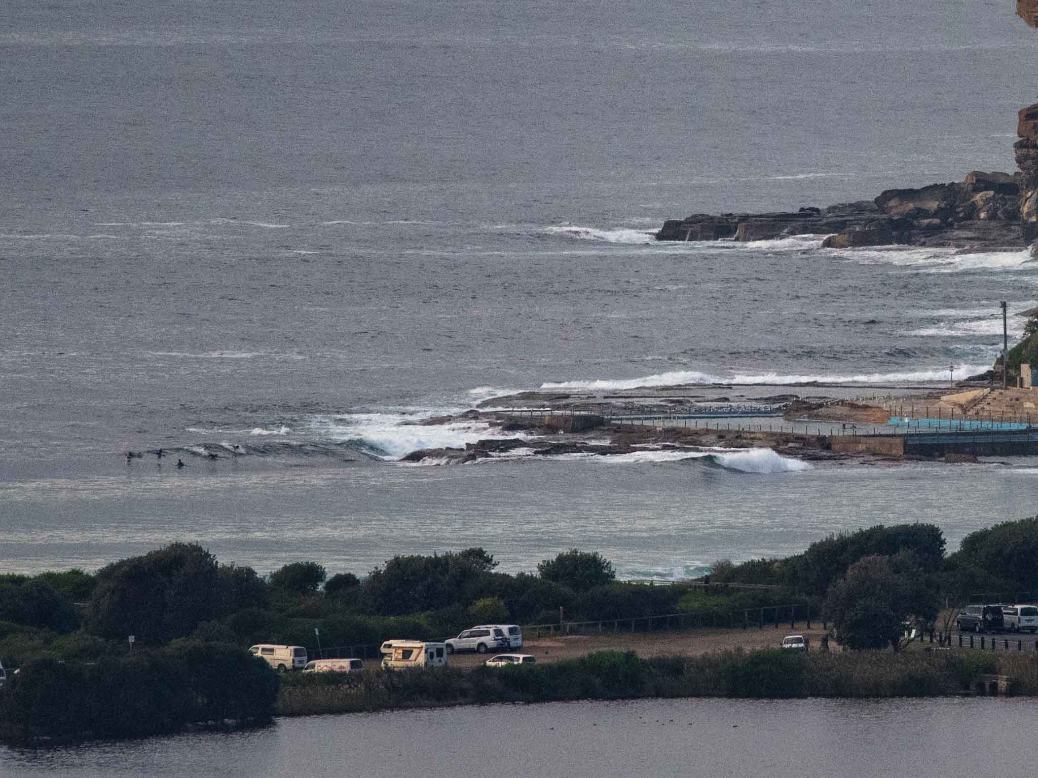
Dropped a bit faster than I’d hoped (having passed on the weekend crowds and big, lumpy conditions), sometimes you should take the bird in hand. This morning at Dee Why saw a small group of hopefuls at the point waiting for the infrequent rideable bumps. I watched for quite awhile and they didn’t get anything, so unless you love surfing next to the rocks, the beachies may be a better option for size. Can’t really tell from my vantage point if there’s been any change to the banks north of Dee Why, but the stretch to about No Mans looked pretty straight, albeit shoulder high on the bombs.
Wind lightly offshore under broken high cloud. The MHL 0600 data showed 1.8 metres of 10-second energy from 156° (S-SSE), which is down by more than a metre since this time yesterday. Beachwatch says the water’s 21C and the morning high tide is 1.5 metres at 0800. It drops a metre to the low at 1345. We’re going to a high of 19 with a possible shower in the cards as well.
Tomorrow promises to be a rather different story. There’s a 100% chance of rain – possibly 30-50 mm – and it’ll be 20-30 kts from the south. Swell is set to be completely nutty. First, a rapidly increasing southerly component is expected to fill in during the morning and at its peak be into the 4-6 metre range, plus there’s set to be a metre of east which will go SE at 1-2 metres in the afternoon. So, probably limited to no safe surf prospects for Tuesday…
The southerly will still be going pretty hard Wednesday morning, but both wind and swell will be on the fade. There may be some options in the corners, particularly in the afternoon. But we’ll see.
Thursday currently looks like be the best option for the coming week according to the models. If the more hopeful predictions are right, it could be sunny with offshores and fun size SSE-SE swell. Friday could see another burst of southerly wind and swell and rain, so maybe not the day to circle on your calendar. With luck next weekend turns out okay…
Have a top old Monday everyone!
from the BoM
Weather Situation
A front that crossed the state late yesterday will deepen into a low pressure system today near the southern half of the coast. Vigorous southerly winds and heavy surf will develop along southern parts of the coast later today and extend northwards during Tuesday in response to the low.
Forecast for Monday until midnight
- Winds
- Westerly 15 to 20 knots.
- Seas
- Below 1 metre, increasing to 1 to 1.5 metres during the morning.
- Swell
- Southerly 1.5 to 2 metres.
- Weather
- Partly cloudy. 70% chance of showers and the chance of a thunderstorm.
Tuesday 4 June
Gale Warning for Tuesday for Sydney Coast
- Winds
- West to southwesterly 10 to 15 knots turning southerly 20 to 30 knots during the morning. Winds reaching up to 45 knots during the day.
- Seas
- 1 to 1.5 metres, increasing to 3 to 5 metres during the morning.
- 1st Swell
- Southerly 1.5 to 2.5 metres, increasing to 4 to 6 metres during the morning.
- 2nd Swell
- Easterly around 1 metre, tending southeasterly 1 to 2 metres by early evening.
- Weather
- Cloudy. Near 100% chance of showers and the chance of a thunderstorm.
- Caution
- Large and powerful surf conditions are expected to be hazardous for coastal activities such as crossing bars by boat and rock fishing.
Wednesday 5 June
- Winds
- Southerly 20 to 30 knots decreasing to 15 to 20 knots during the afternoon.
- Seas
- 2 to 3 metres.
- 1st Swell
- Southerly 4 to 5 metres, decreasing to 2 to 3 metres during the morning.
- 2nd Swell
- Southeasterly 1 to 2 metres, increasing to 2 to 3 metres during the morning.
- Weather
- Cloudy. 95% chance of showers. The chance of a thunderstorm.

