
Hello Friends,
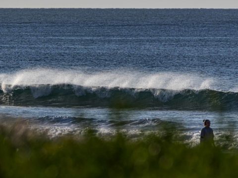
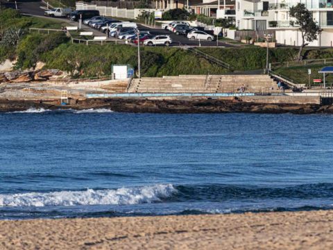
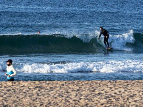
Clear skies as Thursday got started. Wind was out of the WNW at 12-20 kts as we approached low tide at 0805 (it’s back to high at 1440). Had to drop the spouse at the B-line stop, so checked the beach on the way home. The only vaguely surfable waves I saw were near the Lagoon entrance at Long Reef. There were three guys bobbing around waiting for knee to waist high bumps to wobble in. As the pictures show, it was pretty much flat north and south of there.
The Goat will be along later with his thoughts on the outlook, so I’ll confine myself to observing that the models are still showing flatness through to late in the weekend ahead of a potentially interesting south pulse.
Have a great Thursday!
Weather Situation
A series of cold fronts are expected to maintain vigorous westerly winds until later on the weekend, when a low pressure system moves over the southern Tasman Sea and winds then tend southwesterly. The slow movement of this low pressure system looks set to develop large waves later on the weekend.
Forecast for Thursday until midnight
Strong Wind Warning for Thursday for Sydney Coast
- Winds
- Northerly 15 to 20 knots turning west to northwesterly 20 to 30 knots during the morning.
- Seas
- 1 to 1.5 metres, increasing to 2 to 3 metres during the morning.
- Swell
- Northeasterly below 1 metre.
- Weather
- Cloud clearing.
Friday 9 August
Gale Warning for Friday for Sydney Coast
- Winds
- Westerly 25 to 30 knots, reaching up to 35 knots offshore during the day.
- Seas
- 1 to 2 metres, increasing to 2 to 4 metres offshore.
- Swell
- Southerly below 1 metre.
- Weather
- Mostly sunny.
Saturday 10 August
- Winds
- Westerly 20 to 30 knots.
- Seas
- 1 to 1.5 metres, increasing to 2 to 3 metres offshore.
- Swell
- South to southwesterly around 1 metre.
- Weather
- Mostly sunny morning. The chance of a thunderstorm in the afternoon and evening.

