Hello Friends,
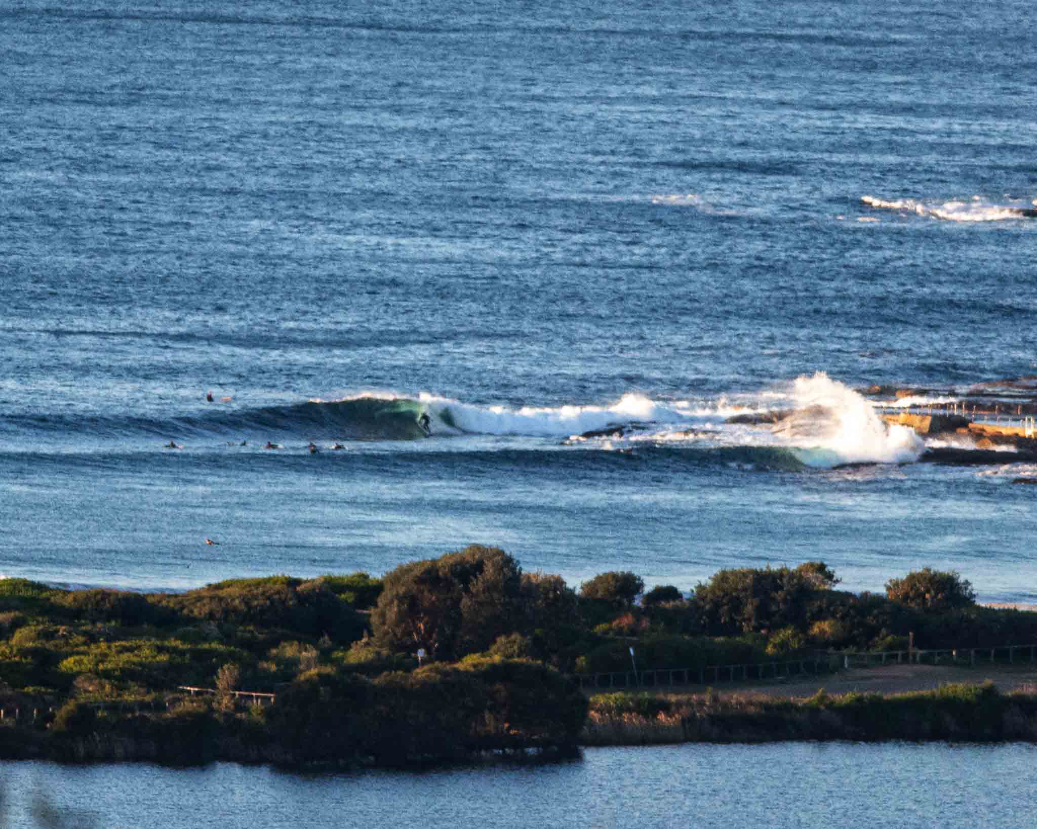
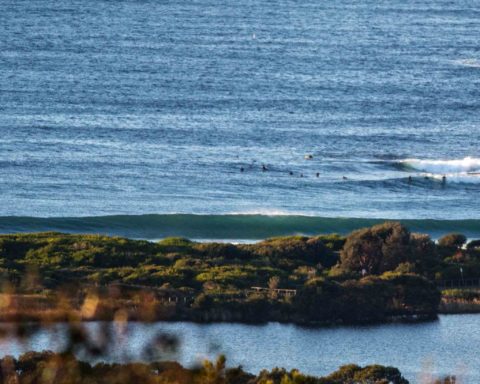
Sets at the point and along the beach were still in the shoulder plus range at around 0700 this morning. Once again, the point was busy but the beach had few takers – evidence that the lack of decent banks continues. Wind was out of the west at 10-12 kts which made the 13C air temp feel sharper. Skies were clear and tide was coming into a 1.3m high at 0740 (it’ll be back to low at 1315).
Outlook is for waist to chest high waves and benign wind conditions to last all day. Tomorrow the predictions are all in agreement – it’ll be smaller but (hopefully) still in the surfable range. Beyond that the prospects are looking less than exciting. So might be a plan to get in today if the schedule permits.
Have a great day everyone!

Weather Situation
A high pressure system is moving steadily across the south of the state and will become established over the Tasman Sea by Wednesday night. It will be the dominant influence on the weather for the rest of the week. A cold front is expected to bring a south to southwesterly change along the southern half of the coast on Friday.
Forecast for Wednesday until midnight
- Winds
- Westerly 10 to 15 knots becoming variable about 10 knots in the morning.
- Seas
- Below 1 metre.
- Swell
- Southerly 1.5 to 2 metres.
- Weather
- Mostly sunny.
Thursday 15 August
- Winds
- Northerly 10 to 15 knots tending northwesterly early in the morning.
- Seas
- Around 1 metre.
- Swell
- Southerly 1 to 1.5 metres, decreasing to around 1 metre during the afternoon.
- Weather
- Sunny.
Friday 16 August
- Winds
- Northwesterly 10 to 15 knots turning southwesterly 15 to 20 knots during the evening.
- Seas
- Around 1 metre.
- Swell
- Southerly around 1 metre.
- Weather
- Sunny.

