
Hello Friends,
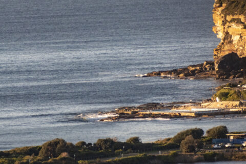
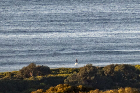
It may be 2 m at 10 seconds from the south out at sea, but as far as Dee Why’s concerned, it’s just about flat. The only person I could see in the 18C water from the RealSurf crows nest was somebody having fun on their electric foil board. A beautiful morning in every other respect – cool, but not cold, sunny skies and 8-10 kts of WNW breeze grooming the tiny swell.
Outlook remains for conditions to be micro through tomorrow morning, but for a little energy to start pulsing up Tuesday afternoon as it head toward a peak into the 1.5+ metre range along the beaches on Wednesday.
Keep your mask handy and stay safe everyone!
Weather Situation
A low pressure system centred to the east of Bass Strait will weaken today, while a high will move into New South Wales from the west. By Tuesday the high is expected to move north over the Coral Sea, as a new low pressure system develops south of the Bight. This system is forecast to bring a series of vigorous cold fronts across southeast Australia during the second half of the week, with windy conditions in most coastal areas.
Forecast for Monday until midnight
Winds
Westerly 15 to 20 knots, reaching up to 25 knots early in the morning.
Seas
1 to 2 metres.
Swell
Southerly 1 to 1.5 metres.
Weather
Sunny.
Tuesday 18 August
Winds
Westerly 15 to 20 knots turning northwesterly during the morning. Winds reaching up to 25 knots in the late evening.
Seas
1 to 2 metres.
1st Swell
Southerly 1 to 1.5 metres.
2nd Swell
Easterly around 1 metre.
Weather
Partly cloudy.
Wednesday 19 August
Winds
West to northwesterly 10 to 15 knots, reaching up to 20 knots offshore. In the afternoon winds increasing to 15 to 25 knots, reaching up to 30 knots offshore.
Seas
Around 1 metre, increasing to 1.5 to 2.5 metres offshore.
Swell
Easterly around 1 metre.
Weather
Partly cloudy. The chance of a thunderstorm in the afternoon and evening.

