
Hello Friends,
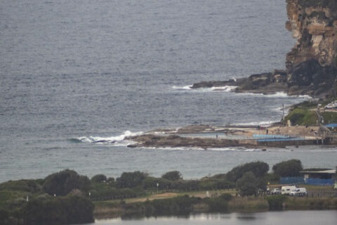
Not much energy showing at Dee Why this morning thanks to a near absence of swell along the stretch. The offshore buoy data was showing 1.3 metres of 9-second bump from the SSE but, with a high tide at 0630, it was not looking surfable at Dee Why. You might find something in the ankle to knee high range up toward Longy and at other similarly angled stretches along the Sydney coast. The marine forecast is calling for a little uptick in swell but the ENE wind isn’t making it look too appetizing, and the wind’s due to pick up later.
A quick look at the models makes me think maybe the next shot at waves will be around Sunday, when we might see some waist plusses at east spots…
Go well, maintain your distance and take the mask if you’re going into enclosed public spaces.
Weather Situation
A weak trough of low pressure lies on the northern New South Wales coast, and another on the south coast. Both troughs will decay today as a high pressure system moves across the state from the west, to be centred over the Tasman Sea by evening. The next trough is expected to reach southern and central waters during Thursday.
Forecast for Tuesday until midnight
Winds
Easterly below 10 knots tending northeasterly 15 to 20 knots in the morning.
Seas
Below 0.5 metres, increasing to around 1 metre around midday.
Swell
Southerly around 1 metre inshore, increasing to 1 to 1.5 metres offshore.
Weather
Partly cloudy.
Wednesday 16 September
Winds
Northerly 15 to 25 knots.
Seas
1.5 to 2.5 metres.
Swell
Southerly around 1 metre inshore, increasing to 1 to 1.5 metres offshore.
Weather
Mostly sunny.
Thursday 17 September
Winds
Northerly 15 to 20 knots.
Seas
1 to 2 metres, decreasing to 1 metre during the morning.
1st Swell
Southerly around 1 metre.
2nd Swell
Northeasterly around 1 metre.
Weather
Mostly sunny.

