
Hello Friends,
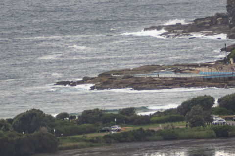
A pretty ho-hum morning surfwise. for Dee Why. Heavy overcast skies threatening to sprinkle and 8-10 kts of SSW do not a pretty picture make. Swell at sea was 1.7 metres dead south at 6 seconds apart and that was translating into knee to waist high gutless dribble at Dee Why. The weather forecast calls for a shower or two across the day as we head to a high of 24C. The wind will come around to the SE soon, so prospects are unlikely to improve.
It looks as though these settings will stay in place through to late Friday at least.
Take care, take the mask and stay safe everyone!
Weather Situation
A weak trough of low pressure along the northern coast will strengthen again with a surge of south to southeasterly winds and move towards the Queensland border by early Thursday. Winds will remain south to southeasterly over most coastal waters over the coming days as a slow moving high pressure system over the Bight extends a ridge along the coast behind the trough.
Forecast for Wednesday until midnight
- Winds
- Southerly 15 to 20 knots turning southeasterly in the late afternoon.
- Seas
- 1 to 1.5 metres.
- 1st Swell
- Southerly 1 to 1.5 metres.
- 2nd Swell
- Northeasterly around 1 metre.
- Weather
- Partly cloudy. 50% chance of showers.
Thursday 7 January
- Winds
- Southerly 15 to 20 knots turning southeasterly in the afternoon.
- Seas
- 1 to 2 metres.
- 1st Swell
- Southerly 1 to 1.5 metres.
- 2nd Swell
- East to northeasterly around 1 metre.
- Weather
- Partly cloudy.
Friday 8 January
- Winds
- Southeasterly 15 to 20 knots.
- Seas
- 1 to 1.5 metres, increasing to 1 to 2 metres offshore.
- Swell
- Southeasterly 1 to 1.5 metres.
- Weather
- Partly cloudy.
