Postcards from Cali: raw swell beginning to show
The really big stuff is a good 24-36 hours away, but the slow rolling, long lined forerunners were obvious when I checked learner spot Leadbetter point in Santa Barbara around 3pm local time. Wind was powering up and writing off most spots, but there are little corners that are tolerably sideshore. Heaps of much needed […]
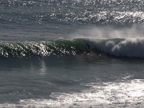
Rincon was firing this morning…(vid)

Check this clip of Rincon this morning from Surfline. I’d call that 8 out of 10… Rincon Live HD Surf Cam. Check out more Surf Cams at Surfline.com
Micro Thursday and a postcard from Cali
Hello Friends, Another day of abject tininess for Sydney. Beautiful otherwise, but with half a metre of 10 sec period east swell, there will be next to nothing for surfers. The sad news is that from my reading of the charts, tomorrow will be flat and Saturday may only see the slightest uptick. But from […]
Micro Wednesday in Sydney
POSTCARD FROM CALI: The Pit, Santa Barbara CA, around midday. Gutless windswell with occasional moments of semi-speed. Hello Friends, Looking at Sydney via the WRL cam shot this morning, I can see that exactly as foretold in the forecast, there is next to nothing going on. What little energy there is, is coming from the […]
Postcard from Cali & a few thoughts on Sydney surf prospects
Hello Friends, Sorry about the silence from your humble servant. I’m back on the other side of the planet again on family business. Looks like you’ve had nice little waves in Sydney, but I’m thinking from the look of the WRL cam at south Narra, it’s not going to be too red hot today for […]
Postcard from Cali: you’re missin’ nothin’ here
Hello Friends, Not much happening on this side of the pond. It is spring after all. Weak and tiny west wind swell is unsurfably tiny. Hoping for an improvement on the weekend… Meanwhile, back home (where I’ll be mid next week) the MHL Sydney buoy is reporting 9 second period SE swell at two metres. […]
Postcard from Cali: little in Santa Barbara too
Hello Friends, After looking at the MHL data for Sydney this morning (1 metre of 5 sec period south wind chop) and the BoM’s wind report (15-20 kts of SSE), I was unsurprised to see it looking pretty paltry on the cams. Looks like an excellent day to get some work done. You might want […]
Postcard from Cali: fading west wind swell
Hello Friends, Your jet-lagged correspondent had the opportunity to see beaches from Malibu to north of Rincon this morning and can report that it was mostly waist high to smaller along much of the coast as a little west wind swell ebbs away. Water was brown most places thanks to 50mm of rain a couple […]
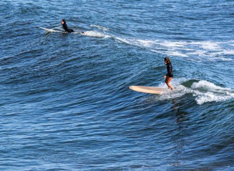
Yesterday at the Ranch…
My little brother the glider pilot happened to get an invite to Hollister Ranch yesterday. Fortunately he took his camera and got a few snaps of a very nice looking west swell doing its thing at Drakes… Drakes, Hollister Ranch Drakes set up, Hollister Ranch Only one boat of surfers on it at […]
Postcard from Cali (one last time) & waves for Sydney
Hello Friends, Flying day for yours truly. At around 3pm Sydney time my Delta 777 flight will be climbing away from LA as it heads for Oz. Tomorrow morning I’ll be back in the land of warm water, and I hope, a wave or two to clear the jet-lagged brain. It looks as though the […]