Waves under cold grey skies
Hello Friends, For the last week the models have been predicting an uptick in swell for today. It’s come up and as of 0600the MHL buoy was showing two metres of 7-sec south swell. The point was picking it up and producing occasional sets into the chest plus range It looked to be similar size […]
South pulse this morning

Hello Friends, The plan was to hit it early this morning before the wind kicked in. A 7-second period south wind swell of two metres was providing weak looking waist to chest high peaks along the Dee Why stretch. The short period means that it’s really not wrapping onto the point and I’d expect the […]
Grey skies, small and junky but not totally flat
Hello Friends, Just a quick note for now to say that there are waist plus sets to be had amongst the choppy greyness of Friday morning. Wind is south 10-20 kts, swell is mainly south (but there’s NE in it too). The south component is around 2 metres at 7 seconds though. Next tide is […]
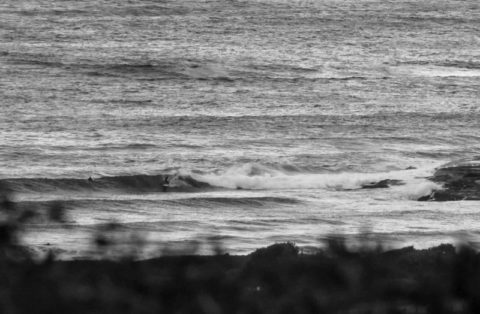
Waves happening this morning
Hello Friends, Big smile on your webmaster’s face this morning. Yesterday evening we went over the line on the crowdfunding drive. 175 generous people got us there with 6 days to spare. So now the goal is to see how far past that mark we can get before the campaign ends! Surf situation is that […]
Southerly
Wind was out of the S-SE at 10-20 kts as of 0600 and skies are forecast to be partly cloudy all day with a high around the 24 mark. Swell was coming mainly from the south. It was about two metres out at sea, but with an average period of only 7 seconds, I would […]
Beautiful morning and tiny but not flat
Hello Friends, A little bit of wave energy showing at Dee Why this morning whilst the wind was still offshore. Swell at sea is out of the south at a couple metres, but the average period is still an anaemic 7 seconds. So, we’re talking knee to waist at Dee Why and probably a […]
Not much of a morning but swell inbound
Hello Friends, Cold, rainy, onshore, small, messy… hmmm… have left anything out? Wind was SSE for the early, so that didn’t help. And swell was south at a couple metres, but only 7 seconds apart. Fortunately it looks as though that will change. Batemans Bay buoy is showing the average period ramping up pretty quickly. […]
South corner day
Hello Friends, From the look of Dee Why this morning, it would seem to be a good day to be getting on with one’s non-surfing life. The MHL data shows a couple metres of south wind swell out at sea, but the average period is a kitten-weak 7 seconds. That means paltry knee high sets […]
Woeful morning in Sydney
Hello Friends, Do you like southerlies and rain? Well, you got it this morning in Sydney. Wind is pushing along at 15-20 kts right now and is due to pick up into the 20-30 kt range. Tide’s running up to the high at 0900 and Dee Why isn’t the better for it. There was a […]
Southerly messiness
Hello Friends, A southerly with short period south windswell is producing messy waist high dribble at Dee Why and I can only assume that most other spots along our coast are either similar or possibly worse. Wind’s about 20 kts and there’s a 60% chance of showers through the day, plus the forecast models (and […]