Articles tagged with "SSE-1.5m-8s"

Take another turn in the holding pattern

Posted by: on October 14th, 2011

Hello Friends,

No real change to the key numbers this morning for Sydney surfers. We still have a weak little SSE wind swell of around 1.5 metres with an average period of close to 8 seconds. As I tapped out the report this morning a little before 0800, the wind was a chop-inducing ENE’r of 10-15 kts. Toss in another round of featureless grey skies, and it’s not much of a picture.

I think you can pretty much write this one off. Although, if you are extra keen, you might want to look at NE corners late this afternoon. The Bureau is calling for the swell to swing more easterly and to push up a touch. But the ENE wind is set to be a feature all day long.

Oh well, what can ya do?

As always, I’ll keep an eye on things and if there’s a significant improvement, the news will appear here!

Go well one and all.

Weather Situation

A high pressure system over the southwestern Tasman Sea is moving south-southeast and weakening maintaining a ridge to the Coral Sea. Later on Saturday a cold front is expected to move over the southern Tasman Sea later on Saturday bringing southerly change along the New South Wales coast.

Forecast for Friday until midnight

Winds
East to northeasterly 10 to 20 knots.
Seas
1 to 1.5 metres.
Swell
Southeasterly 1 metre tending easterly 1.5 metres late this evening.

Saturday 15 October

Winds
East to northeasterly 10 to 20 knots tending north to northeasterly around dawn then tending northeast to northwesterly up to 15 knots during the morning.
Seas
Up to 1.5 metres.
Swell
Northeasterly about 1.5 metres.

Sunday 16 October

Winds

West to southwesterly 10 to 20 knots tending mainly southeast to southwesterly up to 10 knots during the afternoon. Winds tending northwesterly up to 20 knots during the evening.

Seas

Up to 1.5 metres decreasing to below 1 metre during the evening.

Swell

Easterly about 1.5 metres.

Friday wrap

Posted by: on June 17th, 2011

Swell was pretty juicy this morning, but it began fading noticeably from late morning. As of sunset the average period was just 8 seconds (well down on the 11 sec we had at daybreak) and the average size dropped from 3 metres to a little under 2m. The direction’s changed too. It’s gone from SE to south, so that contributed no doubt to the rapid decline in size this afternoon.

The Bureau says that tomorrow’s weather will be similar to today’s – ie mainly sunny with w-sw winds of 20-30 kts. The wave prediction models are projecting a continuing gradual decrease in swell energy and from the way things are shaping up, it looks as though we can probably expect waist to chest high at south spots (the Bureau reckons it’ll be east, but the MHL buoy is showing the swell already south, so I’m going with that!).

I did a bit of shooting at Dee Why this morning, so I’ll have a fresh gallery up at some point tomorrow.

Have a great Friday evening and see you tomorrow.


Down Cronulla way

Posted by: on August 4th, 2010

Hello evening visitors!

Finally have added a new surf spot to the life list – Elouera. PB and I made a jaunt down to the lovely shire to see what was doing. He’s been down there a bit lately so was able to give me the tour. We checked Elouera and the Wall first. Little SE swell of maybe 1.5m at around 8-9 seconds apart was coming in and the wind was light offshore. Plus it was sunny and comparatively mild. Not super crowded either. In fact, you’d have to say it was uncrowded by Sydney standards. Went down to look at Cronulla point, Shark Island and Sandshoes too, but ended up returning to the long waist to chest high lines of Elouera. Later when we got out we talked to a guy who lives just around the corner from the beach who assured us we’d just got very lucky. I’ll take it! Thanks Huey.

A quick look at the charts tonight makes me think that tomorrow will probably smaller again that at close of play today. From the current run of the WAMs, it seems that we’re in for declining conditions across the next couple days, before the possible return of surfable south swell energy sometime late Friday. It’s not too bad an outlook overall with the models suggesting something more or less across the next 7 days in the Sydney region. Hope Huey doesn’t change his mind!

Go well and catchya again tomorrow.


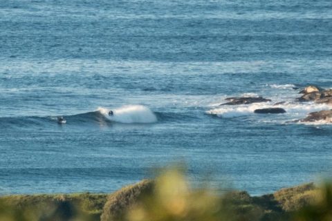
Catching little ones at No Man’s

Posted by: on August 18th, 2009

Hello Friends,

Since the rest of the week is looking not the best for surfin’, I made room in the schedule to get some water time. After scoping Curly and Dee Why (didn’t feel like travelling far), opted for the latter. Wandered up toward the pole where I’d spotted some bods hooking little lefts. Turned out a couple of them were the ever smiling Psillakis brothers. Set waves were in the chest high plus range, but the shutdown percentages were very high indeed. Didn’t really bag any great shots with the Lumix FT1, but I’ll share anyway…

Shooting into the glare at another little No man's left.

Shooting into the glare at another little No man's left.

The lefts were better than the rights.

The lefts were better than the rights.

Late arvo update: just don’t be picky

Posted by: on February 19th, 2009


At around 330pm you could still get the odd little set wave.

At around 330pm you could still get the odd little set wave.

Just a quick little update for our late afternoon visitors…

Wind is around to the N to NE at about 15 kts, so surface conditions aren’t as clean as this morning at most places. Average height of the SSE swell is around 1.5 metres and the period is bumping along at 8 seconds.

I was down Dee Why way around 330 this afternoon and noticed that there were still a few little peaks up the beach. Huey’s switched the point off, but if you aren’t too picky about surface conditions, don’t mind a wait for a set, and have the right equipment. Based on what I saw earlier today, I’d expect similar conditions to be on offer at Freshy, Curly, Northy, Cooks Tce, Mona Vale, Bungan, Newport… you get the picture – pretty much anywhere with exposure to south-ish energy.

Here’s the Bureau’s updated call:

Friday: Wind: SW/SE 10/15 knots, tending SE/NE 10/15 knots during the afternoon, NE 5/10 knots at night.Sea: 1 to 1.5 metres, abating to less than 1 metre at night. Swell: E/SE 2 to 2.5 metres decreasing to 1.5 to 2 metres later. 
Saturday: Wind: E/SE 10/15 knots. 
Sunday: Wind: SE/NE 10/20 knots.

The next three to four days look as though they’ll be a bit smaller than today, but, with luck, not actually flat. I reckon my fishy will be just the thing. What’re you planning to use?

Nice morning, little waves too

Posted by: on September 24th, 2008
0645: it isn't much, but it's better than yesterday.

0645: it isn't much, but it's better than yesterday.

Hello Friends,

As the change came through yesterday, the skies cleared and the wind kicked up. It was chilly and onshore by the time the sun was low in the sky. The wind dropped overnight and is now WSW at around 5 knots, but it’s due to swing around to the ESE and get up into the 10-15 kt range. Meanwhile, the swell is puttering along from the SSE at a metre or so on a period of just 7 seconds.

That all means its pretty marginal where Dee Why’s concerned. However, marginal is better than flat any day and there is at least a reason for keen folk on long and buoyant objects to get in the water for a few of the waist high sets flopping over up toward the surf club. My guess is there will be similar options around the other stretches of beach with good south exposure.

While the models are currently unenthusiastic about our near-term surf prospects, there is finally something vaguely interesting out at the far end of the forecasts. Essentially, it looks as though today’s weak little pulse will fade back to near flatness as we hit the weekend, but, if those super computers are correct, we might just get a pulse of reasonably solid south swell (2-3 metres at 10 sec) with the current wind outlook being for somewhere in the ENE-NNE range at 10-15 kts. However, I must hasten to add that this is right at the outer most limits of the forecasts, so at this stage, it definitely goes into the watching brief file rather than the diary.

Speaking of forecasts, you may have noticed that I’ve been including short-form tags describing the current swell conditions with my reports. These turn up in the Tag cloud below. I’m sure some of you have been wondering why I’m bothering. Well, here’s the rationale: I figure that over the course of a year, we’ll have seen pretty much every combination of swell direction, size and period that Sydney gets. The idea is to give you a quick way to check out what I reported on those days tagged with a particular combo of values. All you have to do is click on the relevant tag and it will take you to a page that contains all our tags, down the bottom of which you’ll find links to all the reports for days with those conditions. To check out how it works, here’s what happened when we had conditions that matched the forecast for this coming Monday S-2m-10s (remember to scroll to the bottom of the page for those links). Have fun with it!

Hope you’re in for a particularly good Wednesday one and all.

Grey & just about flat

Posted by: on August 6th, 2008

Tiny, but perfectly formed at Dee Why.

Tiny, but perfectly formed at Dee Why.


Hello Friends,

Ocean looks pretty tiny this morning. A good day to be doing other stuff if you want my opinion. Mind you this comes from someone who is currently beset by a plague of flu devils, so you may want to take that into account.

The numbers are not quite as woeful as yesterday, so it could be that at south exposed spots you might be able to pick up something. Average height at sea of the swell off Sydney is around 1.5 metres from the SSE. Average period is about 8 seconds (marginal) but there is some 10 sec component showing in the peak data. And, I see there’s been a little uptick in size down the coast from us, so it could be that the energy levels will increase a little during the day. Certainly a couple of the forecast models are showing that it’ll pick up a couple of feet today. But then it’s set to drop right back to flatness right through the weekend.

Go well!

More showers, but waves continue

Posted by: on July 25th, 2008

Hello Friends,

Waiting for the light to improve so I can get a picture or two… so, thought I might as well get on with writing the day’s contribution to RealSurf.

Swell continues its very gradual decline. As things get started, the MHL Sydney buoy is showing just under 2 metres average heights. The main direction is SSE and the power setting has been nudged down to a marginal 8 seconds.

The Bureau’s call is for the wind to be SW 10-15 kts today. As I write this, the automatic weather stations along the Sydney region coast are showing 7-8 kts from W around to SW.

It looks as though Huey will be keeping the settings much the same for the next few days too. Wind is going to be moderate and from the S-SW through the weekend.

In fact, I see little reason to diverge from the Goat’s call yesterday for the weekend surf prospects.

I’m off to hunt down a pic or two for you now…

Hereya go…

I reckon that headland looks sorta like an Etruscan warrior in profile...

I reckon that headland looks sorta like an Etruscan warrior in profile...

Go well with your day!

 
The latest researches: AAA Replica Online Store, AAA Grade Handbags, High Quality Bags, High Quality Handbags, High Quality Replica Bags, High Quality Replica Handbags, AAA Quality Handbags, AAA Quality Bags, Handbags Online, Handbags Store, Handbags For Sale, AAA Replica Bags, AAA Replica Handbags, 5 Stars Bags, 5 Stars Handbags, Designer Handbags, Luxury Handbags, Designer Bags, Top Style Bags, Top Style Handbags, High Quality European Replica, Top Style Watches, Replica Watches, 5 Stars Watches, Top Brands Watches, Watches For Sale, Luxury Watches, AAA Quality Watches, AAA Grade Watches, High Quality Replica Watches, High Quality Watches, Luxury Replica Watches, AAA Replica Watches, Replica Watches For Sale, Watches Online, Watches Shop, Watches Store, Watches OTC, The Best Watches, The Best Replica Watches.