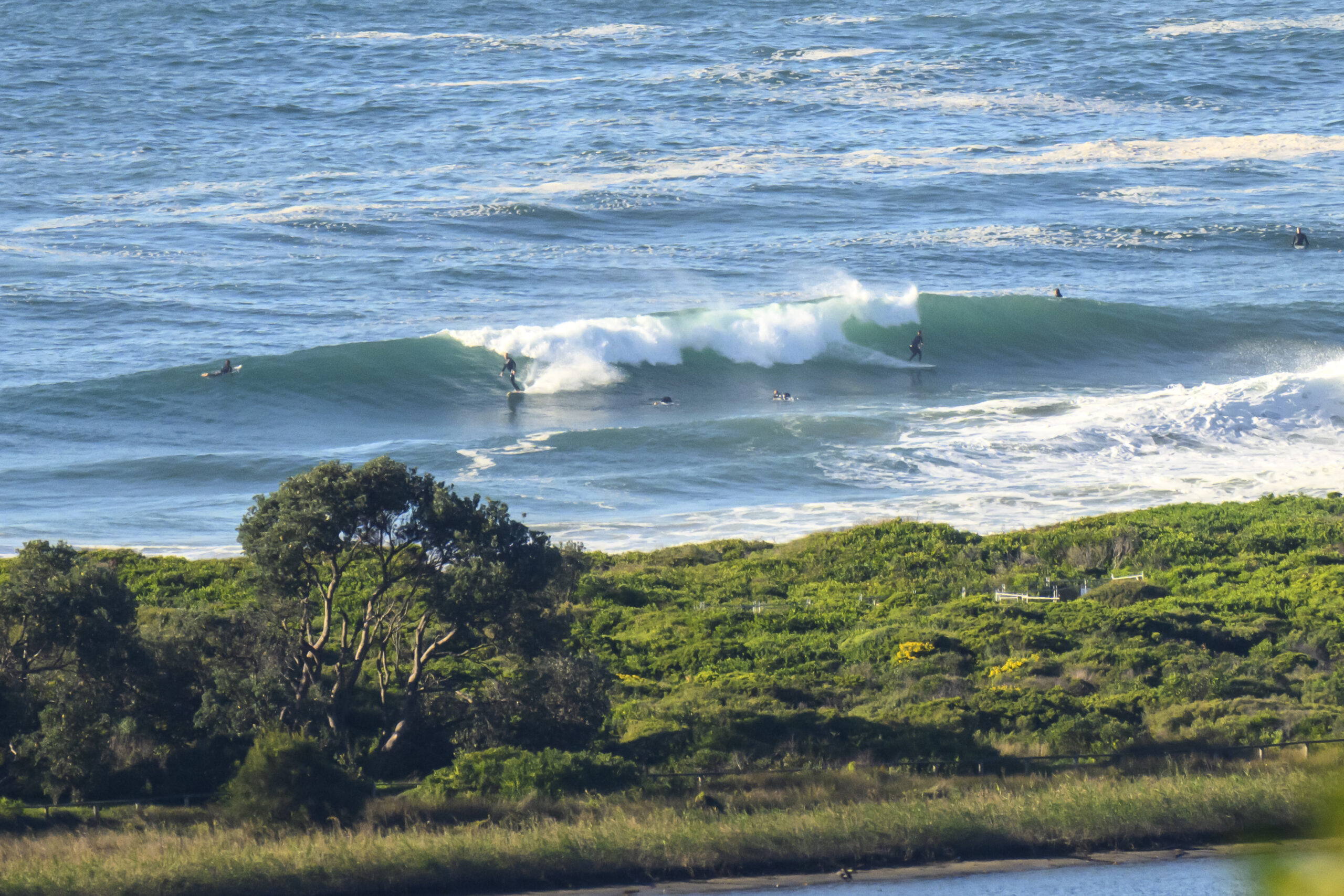
Hello Friends,
Raining steadily when I grabbed the pictures this morning and through the thick atmosphere the point looked to be in the overhead range. But it was heaving around and lumpy looking too (which the pics don’t really show). No one was in the water that I could see. At 0600 the swell was registering 3 metres from the ESE at 11 seconds apart and the wind was WNW at 9-15 kts. Unfortunately the south change will be here shortly and if Wattamolla’s report at 0800 is anything to go by, it’s going to be screaming along the northern beaches too (it was showing 50-60 kts!!).
The wind is set to howl for southerly through the rest of the day and, sadly, to blow very hard for the next couple of days and to generally be southerly. The only glimmer of hope is that we might get some SSW to SW at various times which would at least open up more options. It could be Thursday morning before the wind really backs off much – and then it’s shaping to be SE.
Ah well, with luck there will a few protected corners in play at times.
Have yourself a great Monday, and take care in that wind!


Weather Situation
A complex low pressure system is located off the central parts of the coast with a number of low pressure centres embedded within it. This system is forecast to move north on Monday before slowly heading east over the Tasman Sea during Tuesday and Wednesday. Strong to gale-force winds associated with this system are expected to affect the southern half of the New South Wales coast this morning before heading northward through the central parts of the coast this afternoon. Winds will gradually ease as the system moves east later on Tuesday.
Forecast for Monday until midnight
Gale Warning for Monday for Sydney Coast
- Winds
- West to northerly 15 to 25 knots turning southerly 25 to 40 knots during the afternoon and evening.
- Seas
- Below 1 metre, increasing to 1.5 to 2 metres around midday, then increasing to 2.5 to 4 metres during the afternoon.
- Swell
- Southeasterly 2 to 3 metres.
- Weather
- The chance of thunderstorms.
- Caution
- Large and powerful surf conditions are expected to be hazardous for coastal activities such as crossing bars by boat and rock fishing.
Tuesday 19 August
Strong Wind Warning for Tuesday for Sydney Coast
- Winds
- Southerly 20 to 30 knots.
- Seas
- 2 to 3 metres.
- Swell
- Southeasterly 2 to 3 metres.
- Weather
- The chance of thunderstorms, mainly offshore.
- Caution
- Large and powerful surf conditions are expected to be hazardous for coastal activities such as crossing bars by boat and rock fishing.
Wednesday 20 August
- Winds
- Southerly 20 to 30 knots decreasing to 10 to 15 knots during the evening.
- Seas
- 2.5 to 3 metres, decreasing to 1 to 2 metres during the evening.
- Swell
- South to southerly 2 to 3 metres.

