
Hello Friends,
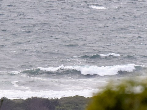
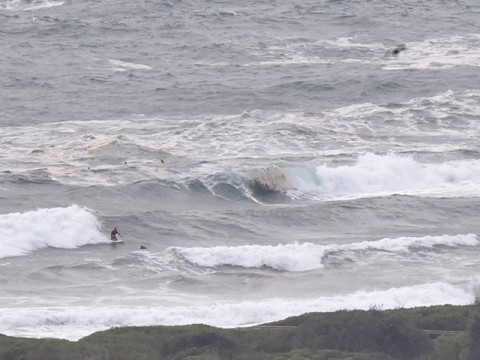
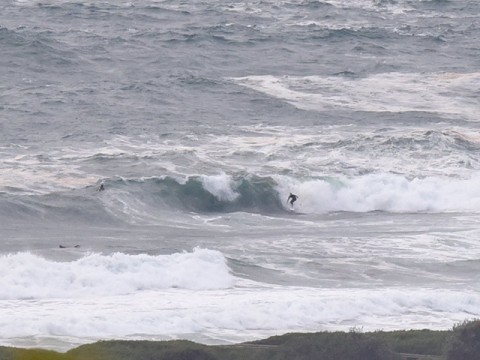
As the Bureau anticipated yesterday evening, the wind has stayed SE overnight and this morning saw 10-15 kts of junk-inducing breezes grinding up any possibility of cleanness. Again, in line with expectations, the swell has cogged down a notch to about the 3 metre mark at 11 seconds apart. It’s swung more to the ESE too, which would be a generally good thing were it not for the baleful wind.
As the pictures show, there were a few hardy types battling the shifty and extremely messy conditions at Dee Why point. It was really more like beach break in that the rides were typically only a couple of turns before they fell apart one way or another. Water looks extremely suss as well. (Beachwatch is saying it’s okay there, but not so hot at Bungan, Mona Vale, Warriewood, Northy, Collaroy, Nth Curly and Freshy to Manly. On the east side, Bronte is likely polluted and Coogee’s not good. Cronulla likewise has question marks over the south end.
Next tide is high at 1330.
Looking ahead the wind pattern should be more east to NE tomorrow and the Bureau says the swell should go east midday. The early morning sesh might be near to okay if the wind backs off overnight, but then it’ll junk up most places thereafter. North corners could be a go.
Monday may be similar to Sunday in that it’ll be best early before the wind gets going.
Some of the models are pointing toward a very brief midweek south pulse but otherwise the situation looks fairly ho-hum across the next week. With luck it won’t actually go flat though.
Have yourself a great Saturday!
Weather Situation
A high over Tasmania is gradually extending a ridge along the New South Wales coast in the wake of a trough, which now stretches across Queensland and the Tasman Sea. During the weekend this high will drift slowly east, resulting in a weaker pressure pattern and easing winds along the coast. Winds will shift more northerly and increase early in the new week as the next low pressure trough approaches from the west.
Forecast for Saturday until midnight
- Winds
- Southeasterly 10 to 15 knots turning easterly below 10 knots in the evening.
- Seas
- 1.5 to 2 metres, decreasing to 1 to 1.5 metres during the morning, then decreasing to 1 metre around midday.
- Swell
- Southeasterly 2.5 metres.
- Weather
- Cloudy. 30% chance of a shower.
- Caution
- Large and powerful surf conditions are expected to be hazardous for coastal activities such as crossing bars by boat and rock fishing.
Sunday 14 December
- Winds
- East to northeasterly 10 to 15 knots decreasing to about 10 knots in the late evening.
- Seas
- Below 1 metre.
- Swell
- Southeasterly 2.5 metres, tending easterly 2 to 2.5 metres around midday, then tending east to southeasterly 2 metres by early evening.
- Weather
- Partly cloudy.
Monday 15 December
- Winds
- Easterly about 10 knots becoming northeasterly 15 to 20 knots during the day.
- Seas
- Below 1 metre, increasing to 1 to 1.5 metres during the afternoon.
- Swell
- Easterly 1.5 to 2 metres.
- Weather
- Partly cloudy.
