
Hello Friends,
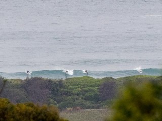
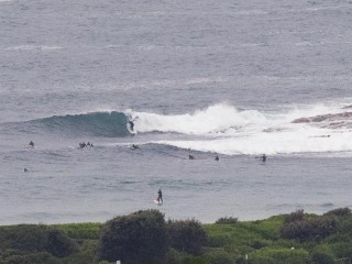
Although the MHL buoy was still showing 1.8 metres of 12-sec SSE swell at 0600, the drop from yesterday’s crazy bigness was dramatic. Set wave faces are still getting toward the head high mark on the stand outs, but for the most part it’s looking like waist to chestish at Dee Why.
Point was well populated early and the beach had a reasonable crew as well. Tide’s high at 1045, so things were definitely looking fat and full.
Winds were light for the early under high overcast. Outlook is for a weak S-SE change later this morning. Surface conditions were comparatively smooth and the line relatively clean, but as that wind takes hold, I’d expect the optics to deteriorate. Still, if you don’t mind a kind of sloppy look to things, there should be something rideable all day.
Outlook for tomorrow isn’t too special – smaller still and a weakening period, so I’m expecting marginal conditions as we head into what is currently shaping to be 4-5 days of micro to flat settings. Hope those models have it wrong!
Right now it seems that we might have a big east pulse late next weekend – but with a lot of wind…
Have yourself a great Sunday!
Weather Situation
A low pressure trough extends over central and southeastern New South Wales today straddled between a weak high pressure system over the Tasman Sea and a high ridge extending into the west. Very little change in the synoptic pattern is expected over the next few days with a series of cold front passing to the south shifting the trough slightly further north followed by a weak southerly change.
Forecast for Sunday until midnight
- Winds
- North to northeasterly 10 to 15 knots ahead of a south to southeasterly change of 10 to 15 knots in the late morning. Winds turn back to the east to northeast by evening.
- Seas
- Around 1 metre, decreasing below 1 metre around midday.
- Swell
- Southerly 1.5 metres, increasing to 1.5 to 2 metres offshore.
- Weather
- Partly cloudy. 30% chance of a shower during the morning and afternoon. The chance of a thunderstorm offshore in the morning and early afternoon.
Monday 9 March
- Winds
- North to northeasterly 10 to 15 knots ahead of a south to southeasterly change in the morning.
- Seas
- Below 1 metre.
- Swell
- Southerly 1 to 1.5 metres, tending southeasterly around 1 metre during the morning.
- Weather
- Partly cloudy. 20% chance of a shower in the morning.
Tuesday 10 March
- Winds
- South to southeasterly 10 to 15 knots turning east to northeasterly during the evening.
- Seas
- Below 1 metre.
- Swell
- East to southeasterly below 1 metre.
- Weather
- Partly cloudy. 60% chance of showers.

