Hello Friends,
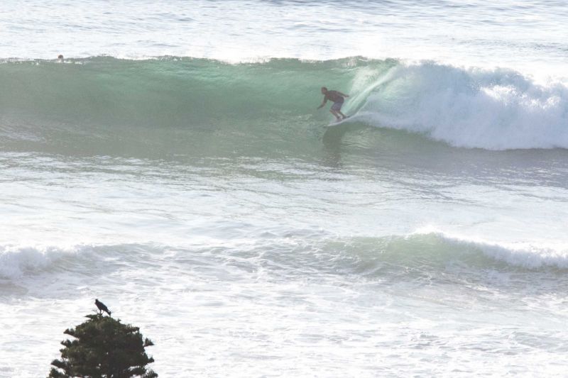
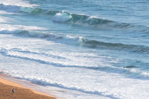
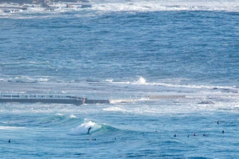
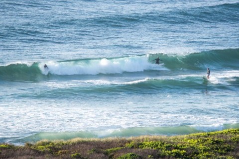
The NE’r was making itself felt at 0700, but there were shoulder plus waves to be had if you were in the right spot at the right time. The combo of 9sec 2.4 metre SE and a similar size NE wind swell was providing ample energy. That said, when I checked the Dee Why to Longy stretch, it seemed that people were struggling to get into them and the shut down percentage was very high. As you might expect, it was pretty busy too.
The Bureau tells us that the NEr will be 15-25 kts before long. The swell should hang in there, but obviously the options will be narrowing down to just the NE spots. Speaking of which, North Narrabeen looked about the best of the bunch at 0700, but although there was size and power, south Narrabeen was just an unending series of shutdowns.
Tomorrow sees the arrival of potentially gale force southerlies and it’ll still be strong but SE on Monday. Looks like this morning is the pick.
The week ahead looks kind of so-so. Not horrible and hopeless, but small to marginal across the front half of the week, with a slight uptick toward next weekend.
Have yourself a top old Boxing Day one and all!

Weather Situation
A high pressure system over the southeastern Tasman Sea with a ridge to the northwest is moving east directing north to northeasterly winds along New South Wales coast. Northerly winds will increase during Saturday ahead of a vigorous southerly change associated with a strong cold front crossing the Tasman Sea developing on the south coast in the afternoon. The change will reach Illawarra Waters Saturday evening, Sydney Waters overnight and the far north coast Sunday afternoon. Winds are expected to gradually ease from the south later on Sunday and during Monday as a high pressure system moves near the Bass Strait extending a ridge to north.
Forecast for Saturday until midnight
- Winds
- North to northeasterly 15 to 25 knots tending north to northwesterly 15 to 20 knots in the late evening.
- Seas
- 1 to 1.5 metres, increasing to 1.5 to 2 metres around midday.
- Swell
- Easterly 1.5 metres.
- Weather
- Becoming cloudy. 80% chance of showers. The chance of a thunderstorm.
Sunday 27 December
Gale Warning for Sunday for Sydney Coast
- Winds
- Southerly 20 to 30 knots turning southeasterly 20 to 25 knots in the late evening. Winds may reach up to 35 knots at times in the morning.
- Seas
- 1.5 to 2 metres, increasing to 2 to 3 metres during the morning.
- 1st Swell
- Southerly below 1 metre, increasing to 1.5 to 2.5 metres during the morning.
- 2nd Swell
- Easterly 1 to 1.5 metres, decreasing to around 1 metre during the morning.
- Weather
- Cloudy. 50% chance of showers. The chance of a thunderstorm offshore in the early morning.
Monday 28 December
- Winds
- Southeasterly 15 to 25 knots decreasing to 10 to 15 knots during the evening.
- Seas
- 1.5 to 2 metres, decreasing to 1 to 1.5 metres during the morning.
- Swell
- Southerly 1.5 to 2 metres.
- Weather
- Partly cloudy. 30% chance of a shower.

