
Hello Friends,
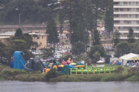
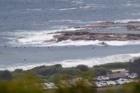
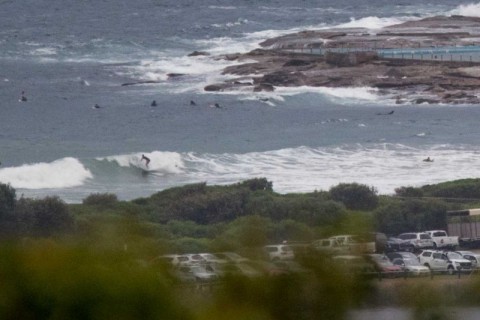
This morning sees scrappy, messy but not flat conditions at Dee Why. Fair number of people in the dodgy looking water and Dee Why itself is in full Australia Day mode under partly sunny skies. However, the forecast is showing a 60% chance of rain.
Swell is still out of the east at about 1.5 metres. Average period has slipped just below the 10-second mark, so the bomb sets today will probably be more like the sets of yesterday.
At Dee Why it’s looking like knee to chest with the odd plus.
Tide’s full as we head to the high at 1040 this morning.
Wind is set to be 10-15 kts from the east to NE today.
Outlook is for the wind to stick to this pattern more or less for the next couple of days and the swell models show the energy levels bouncing around the 10-sec mark with wave heights dropping a bit tomorrow and coming up a bit again on Thursday.
How was that rain last night? Got a good look at the dramatic consequences because it caught me on the road home. Drove from Balgowlah to Collaroy at about 40 kph. I mention it because an hour or so later my phone peeped to tell me that there was a partially treated wastewater discharge event at Warriewood at 0100 Australia Day. Water is “likely to be polluted” from Newport to Collaroy and dodgy along the Dee Why to Narrabeen stretch. But apparently it’s okay everywhere else in Sydney.
Have a great Australia Day one and all.
Weather Situation
A high pressure system passing to the south of Tasmania today extends a ridge along the New South Wales coast, while a low pressure trough lies over the state’s west. Southeast to northeasterly winds will turn more northerly during Wednesday and Thursday as the coastal ridge weakens and the inland trough shifts east. This trough may affect some coastal parts at the end of the week before decaying, although another trough looks set to affect the region during the weekend.
Forecast for Tuesday until midnight
Winds
East to northeasterly 10 to 15 knots.
Seas
Below 1 metre.
Swell
Easterly around 1 metre, increasing to 1 to 1.5 metres offshore.
Weather
Partly cloudy. 50% chance of showers.
Wednesday 27 January
Winds
Easterly 10 to 15 knots turning northeasterly 15 to 25 knots in the afternoon.
Seas
Below 1 metre, increasing to 1 to 1.5 metres during the morning.
Swell
Easterly around 1 metre, increasing to 1 to 1.5 metres offshore.
Weather
Cloudy. 20% chance of a shower.
Thursday 28 January
Winds
North to northeasterly 15 to 25 knots.
Seas
1 to 2 metres.
Swell
Easterly 1 to 1.5 metres, increasing to 1.5 to 2 metres offshore.
Weather
Cloudy. 80% chance of showers. The chance of a thunderstorm in the morning.

