
Hello Friends,
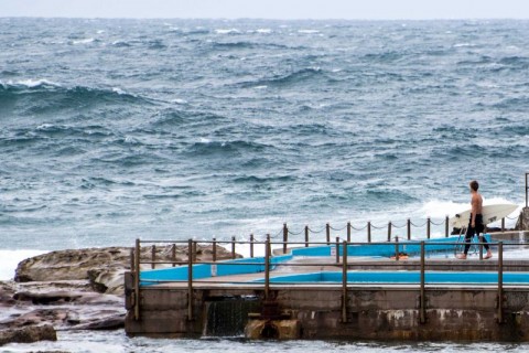
Not a day when many folks want to go for a surf – despite the fact that there is some size around and even a few places that aren’t totally ripped to bits by the SSE wind.
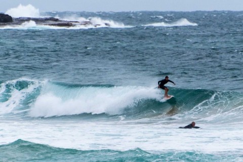
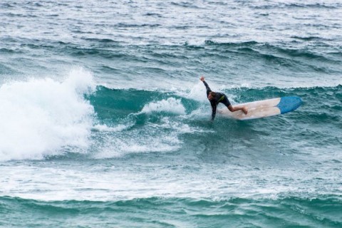
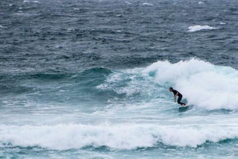
At 0830 there were a few folks having a go at Manly in the rather soft looking waist to chest-ish conditions. Curly was a write-off and at Dee Why you could sort of contemplate the point and the beach. Size there was similar to Manly, maybe a touch bigger. But again there was a flabbiness to the quality.
At 0700 the MHL buoy was detecting 3.5 metres of 10-sec south swell. Tide was high at 0635 and will be low at 1320. As the Goat noted in his forecast last night, the Bureau has hoisted the large and powerful surf conditions warnings. These now extend to Monday – along with that wretched south wind.
A well, at least there are waves of a sort if you’re really hanging out to get wet.
Have a happy Friday one and all!
Weather Situation
A low pressure system lies over the central Tasman Sea while a high pressure system southeast of the Bight extends a ridge to the New South Wales coast. These two systems are directing fresh to strong southerly winds along New South Wales coastal waters. Winds will gradually ease and shift southeasterly over the next two days as the low moves further east and the high moves into the southwestern Tasman Sea, maintaining a ridge to the north coast. Winds will turn northeasterly along southern parts on Sunday and Monday whilst the ridge maintains fresh southeasterly winds along the north coast.
Forecast for Friday until midnight
Strong Wind Warning for Friday for Sydney Coast
Winds
Southerly 20 to 25 knots, reaching up to 30 knots in the morning.
Seas
2 to 3 metres.
Swell
Southeasterly 1 to 1.5 metres, increasing to 1 to 2 metres offshore.
Weather
Cloudy. 50% chance of showers.
Saturday 6 February
Winds
Southeasterly 15 to 20 knots, reaching up to 25 knots offshore in the morning.
Seas
1.5 to 2 metres, decreasing to 1 to 1.5 metres around midday.
Swell
Southeasterly 1.5 to 2.5 metres.
Weather
Cloudy. 20% chance of a shower.
Caution
Large and powerful surf conditions are expected to be hazardous for coastal activities such as crossing bars by boat and rock fishing.
Sunday 7 February
Winds
Southeasterly 10 to 15 knots.
Seas
Below 1 metre.
Swell
Southeasterly 1.5 to 2 metres.
Weather
Cloudy. 20% chance of a shower.
Caution
Large and powerful surf conditions are expected to be hazardous for coastal activities such as crossing bars by boat and rock fishing.
Please be aware
Wind gusts can be 40 percent stronger than the averages given here, and maximum waves may be up to twice the height.
Nearby Coastal WatersThis forecast is also available via scheduled broadcasts on marine radio.
Latest Coastal Observations
Tide Predictions
The next routine forecast will be issued at 4:05 pm EDT Friday.
Product IDN11009

