Hello Friends,
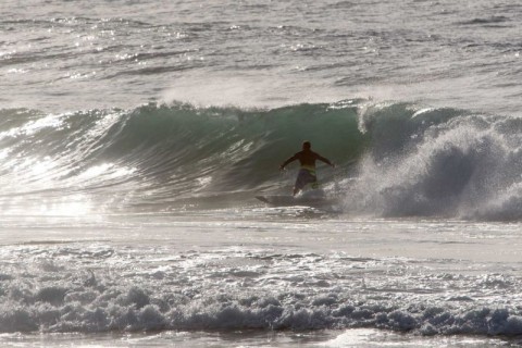
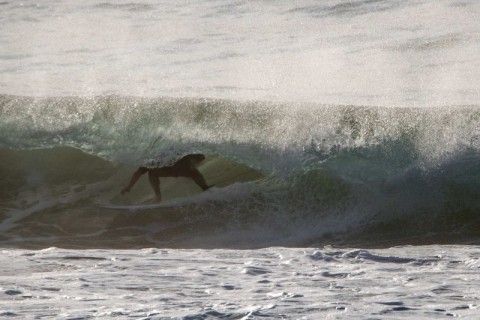
I’ve displeased the computer gods this morning apparently, hence the rather late post-fixing-issues report. Tide’s just hitting the high as I write this at 1000. Half an hour ago when I grabbed this morning’s snaps, surface conditions were glassy thanks to very light winds. Swell was out of the south at a touch under 2 metres at about 9 seconds apart. That mean typical sets were in the chest to head high range at exposed spots. There are a few bomb sets in the mix too, but we continue to have the issue of no banks.
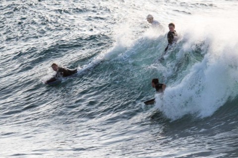
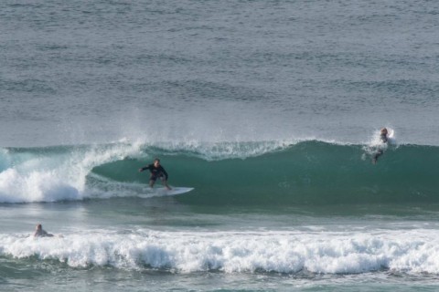
Curly was getting the size when I went by there, but if you could get in three turns before being picked off, you were doing well. Dee Why point had a hopeful crew waiting around for the odd head high take off, but for the most part I’d be calling it waist to chest plus (occasionally). The south end of the Dee Why-Longy stretch was messy and plagued by endless shutdowns. At Long Reef it was clean but not big enough to excite the bombies and as with the south end, over-served with heaping helpings of closeouts.
NE’r will be on it by around lunch, so time to go is now for the south ends…
Have a great Friday!
Weather Situation
A weak high pressure system off the New South Wales coast will see winds shifting northerly over most waters today. A cold front, currently over the Southern Ocean, is expected to pass to the south during Saturday, bringing a southerly change to southern and central parts of the coast. Behind this, a new high is forecast to drift across the region during Sunday and Monday, accompanied by a return to generally northerly winds. The next front is not likely to arrive until at least mid-week.
Forecast for Friday until midnight
Winds
Variable about 10 knots becoming north to northeasterly 15 to 25 knots in the afternoon.
Seas
Below 1 metre, increasing to 1 to 2 metres during the afternoon.
Swell
Southerly 1.5 to 2 metres, decreasing to around 1 metre during the afternoon.
Weather
Partly cloudy. 20% chance of a shower offshore.
Saturday 2 April
Winds
North to northwesterly 15 to 25 knots turning west to southwesterly below 10 knots in the morning then tending southeasterly 10 to 15 knots in the evening.
Seas
1 to 2 metres, decreasing below 1 metre during the morning.
Swell
Southerly below 1 metre.
Weather
Mostly sunny day. 20% chance of a shower at night.
Sunday 3 April
Winds
Southeasterly 15 to 20 knots turning east to northeasterly 10 to 15 knots during the afternoon.
Seas
1 to 1.5 metres, decreasing to 1 metre during the morning.
Swell
Southerly around 1 metre, increasing to 1 to 1.5 metres during the morning.
Weather
Partly cloudy. 60% chance of showers.
Please be aware
Wind gusts can be 40 percent stronger than the averages given here, and maximum waves may be up to twice the height.
Nearby Coastal Waters