
Hello Friends
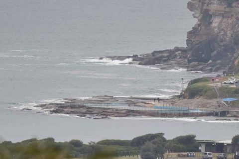
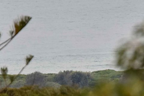
A murky morning with the prospect of rain at near 100% – and not much of anything in the way of a wave showing at the bits of Dee Why I can see from the crows nest.
At 0800 the wind was light from the WSW but it should start picking up soon and by this afternoon it’ll be around to the N to NE at 25-30 kts.
According to the latest MHL data, there’s around 1.5 metres of south swell coming our way. The problem is that the period is only around 8 seconds.
This morning’s swell models are showing the energy levels coming up over the next 24 hours and peaking overnight and tomorrow morning at close to the 3 metre mark from the south. However the period isn’t expected to change much, so right now it doesn’t look as though we’ll see anything terribly impressive size-wise. Winds tomorrow are set to be 25-30 kts from the N to NW and the Bureau’s warning of large and powerful surf conditions. It then looks as though we’ll have a week of fairly marginal declining to just about flat toward Friday. However, most of the long range models are predicting another potentially big swell event from Saturday onward…
Have yourself a top old Sunday one and all and keep on smilin’!
.
.
Weather Situation
A high pressure system near New Zealand extends a ridge to the northwest directing northerly winds along the New South Wales north coast while a low pressure trough is deepening off the south and central coasts. On Sunday night, a low is expected to develop within the trough, most likely near central parts of the coast, then track southwards before moving rapidly away from the New South Wales coast during Monday. Winds are generally expected to strengthen over New South Wales waters as the low develops.
Forecast for Sunday until midnight
Gale Warning for Sunday for Sydney Coast
Winds
Southeast to southwesterly 10 to 15 knots tending easterly 15 to 20 knots in the morning then turning north to northeasterly 25 to 30 knots in the late afternoon. Reaching up to 35 knots in the evening.
Seas
1 to 1.5 metres, increasing to 2 to 3 metres around midday.
1st Swell
South to southeasterly around 1 metre.
2nd Swell
Easterly around 1 metre.
Weather
Cloudy. Near 100% chance of rain. The chance of a thunderstorm from the late morning.
Monday 20 June
Gale Warning for Monday for Sydney Coast
Winds
North to northwesterly 25 to 30 knots tending west to northwesterly during the day. Reaching up to 35 knots offshore in the late evening.
Seas
2 to 3 metres.
1st Swell
Northeasterly 1.5 to 2.5 metres, decreasing to 1 to 1.5 metres during the afternoon.
2nd Swell
Southerly around 1 metre, increasing to 1.5 to 2 metres during the afternoon.
Weather
Cloudy. 80% chance of showers. The chance of a thunderstorm offshore.
Caution
Large and powerful surf conditions are expected to be hazardous for coastal activities such as crossing bars by boat and rock fishing.
Tuesday 21 June
Winds
Westerly 20 to 30 knots.
Seas
2 to 3 metres.
1st Swell
Southerly 2 to 3 metres, decreasing to 1.5 to 2 metres during the afternoon or evening.
2nd Swell
East to northeasterly around 1 metre.
Weather
Partly cloudy. 20% chance of a shower.


