Hello Friends,
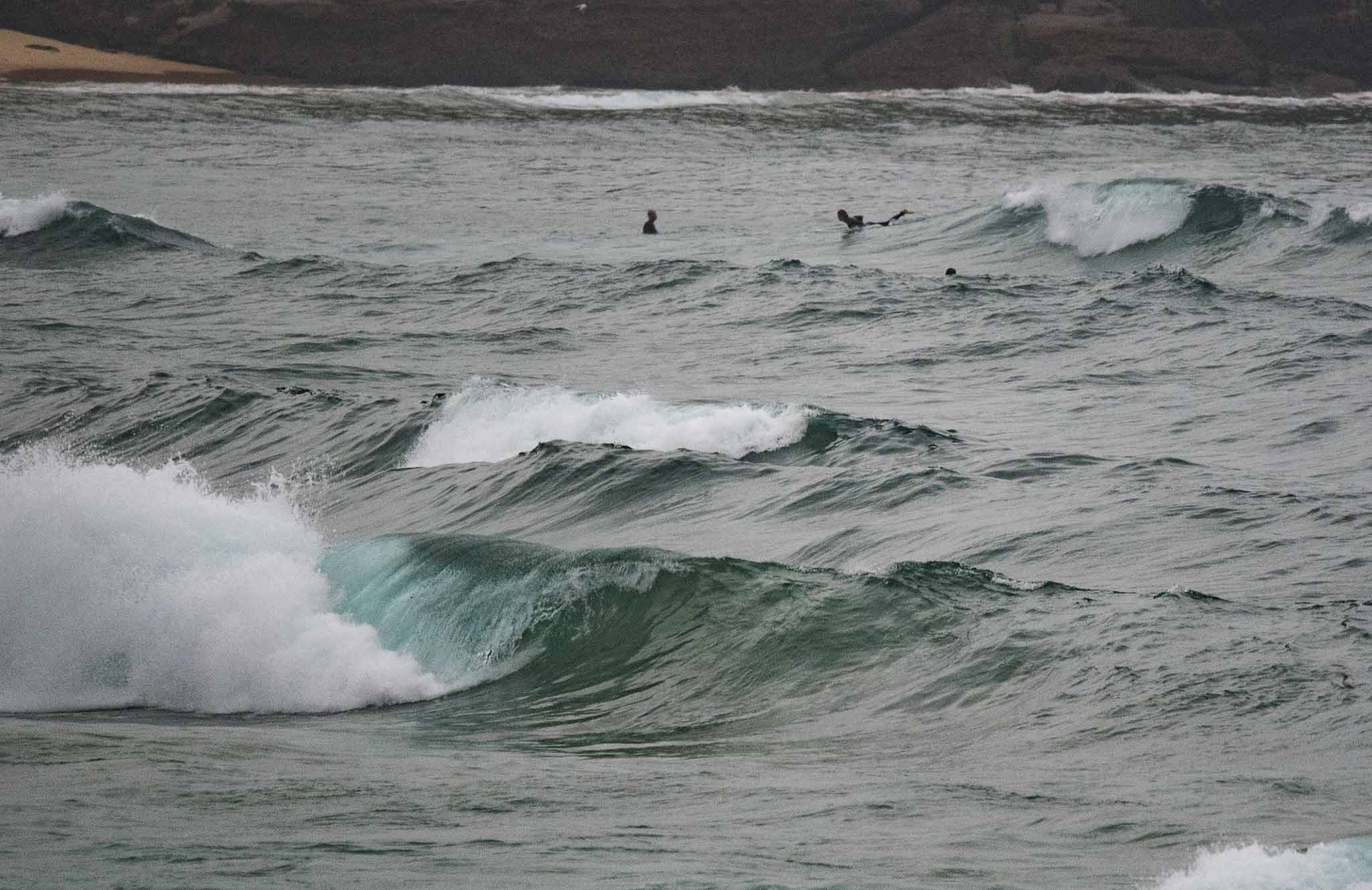
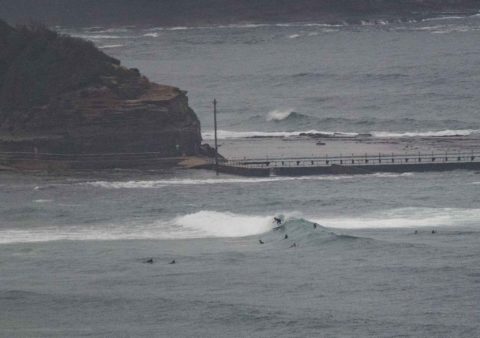
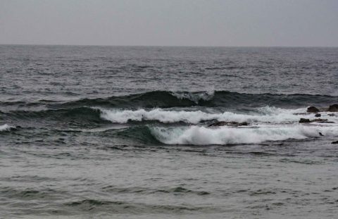
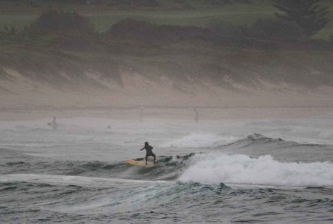
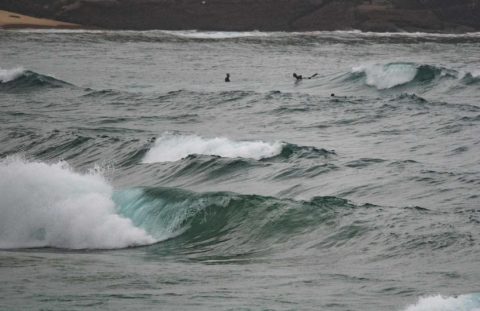
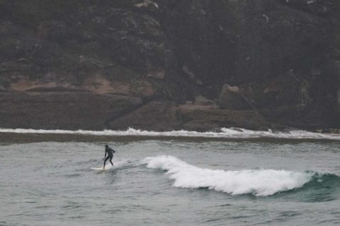
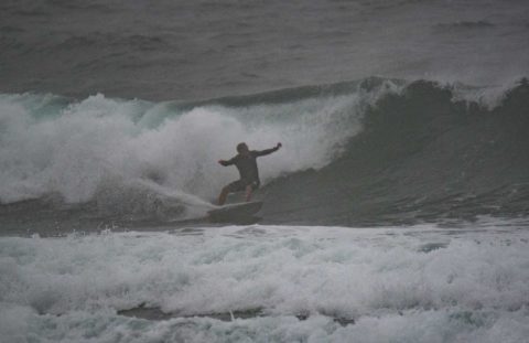
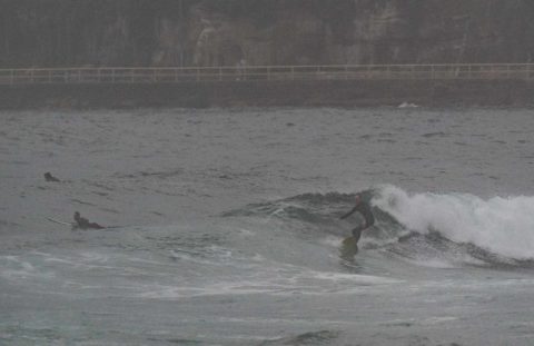
Had a proper look at it from Manly to Collaroy-Narrabeen around 0800 and can report that ahead of the southerly conditions were slightly choppy, fat, lumpy and fairly gutless short period NE wind bump – but there were waves. The best spots I saw (mid-Steyne and Northy) were producing stuff into the chest plus range.
Rain’s just started as I tap out these words and it looks like the southerly is down near the Shire right now. The latest MHL data shows ENE 1.8 m at 9 seconds apart. Tide’s heading to the 1.7m high at 1050.
The Bureau’s hoisted a warning for large and powerful surf conditions late in the day. Of course by then the southerly should be hammering in too. And tomorrow the call is for more blasting south wind. Bah.
The Goat should be along with a forecast later today, so I’ll confine my thoughts to saying that problem across the coming week isn’t likely to be the want of swell, but the abundance of the wind…
Have yourself a great Thursday!
Weather Situation
A high pressure system over the Tasman Sea extends a ridge towards the northern New South Wales coast, directing generally northerly winds along the most of the coast. A strong cold front will bring a vigorous southerly change to southern and central parts of the coast today, continuing north during Friday and intensifying as it meets with a low pressure system near the Queensland border. Winds will ease and shift southeasterly over most coastal waters during the weekend as the low pressure system moves southeast towards New Zealand and a new high pressure system over the Bight extends a ridge to the coast.
Forecast for Thursday until midnight
Gale Warning for Thursday for Sydney Coast
Winds
Northerly 15 to 25 knots ahead of a southerly change 20 to 30 knots during the morning. Winds increasing to 30 to 40 knots in the evening.
Seas
1 to 2 metres, increasing to 2 to 4 metres during the afternoon.
1st Swell
North to northeasterly below 1 metre, increasing to 1 to 1.5 metres offshore during the morning.
2nd Swell
South to southeasterly around 1 metre.
Weather
Cloudy. Near 100% chance of rain. Rain possibly heavy at times. The chance of a thunderstorm.
Caution
Large and powerful surf conditions in the evening are expected to be hazardous for coastal activities such as crossing bars by boat and rock fishing.
Friday 31 March
Gale Warning for Friday for Sydney Coast
Winds
Southerly 25 to 35 knots decreasing to 20 to 25 knots in the middle of the day then tending southeasterly 15 to 20 knots in the evening.
Seas
3 to 4 metres, decreasing to 1.5 to 2.5 metres around midday.
1st Swell
Southerly 2 to 3 metres, decreasing to 2 metres around midday.
2nd Swell
Northeasterly 1 to 1.5 metres.
Weather
Partly cloudy. 70% chance of showers.
Caution
Large and powerful surf conditions in the early morning are expected to be hazardous for coastal activities such as crossing bars by boat and rock fishing.
Saturday 1 April
Winds
Southeasterly 10 to 15 knots.
Seas
2 metres, decreasing to 1 metre during the morning.
1st Swell
South to southeasterly 1 to 2 metres, decreasing to around 1 metre during the afternoon or evening.
2nd Swell
Northeasterly around 1 metre.
Weather
Partly cloudy. 50% chance of showers.

