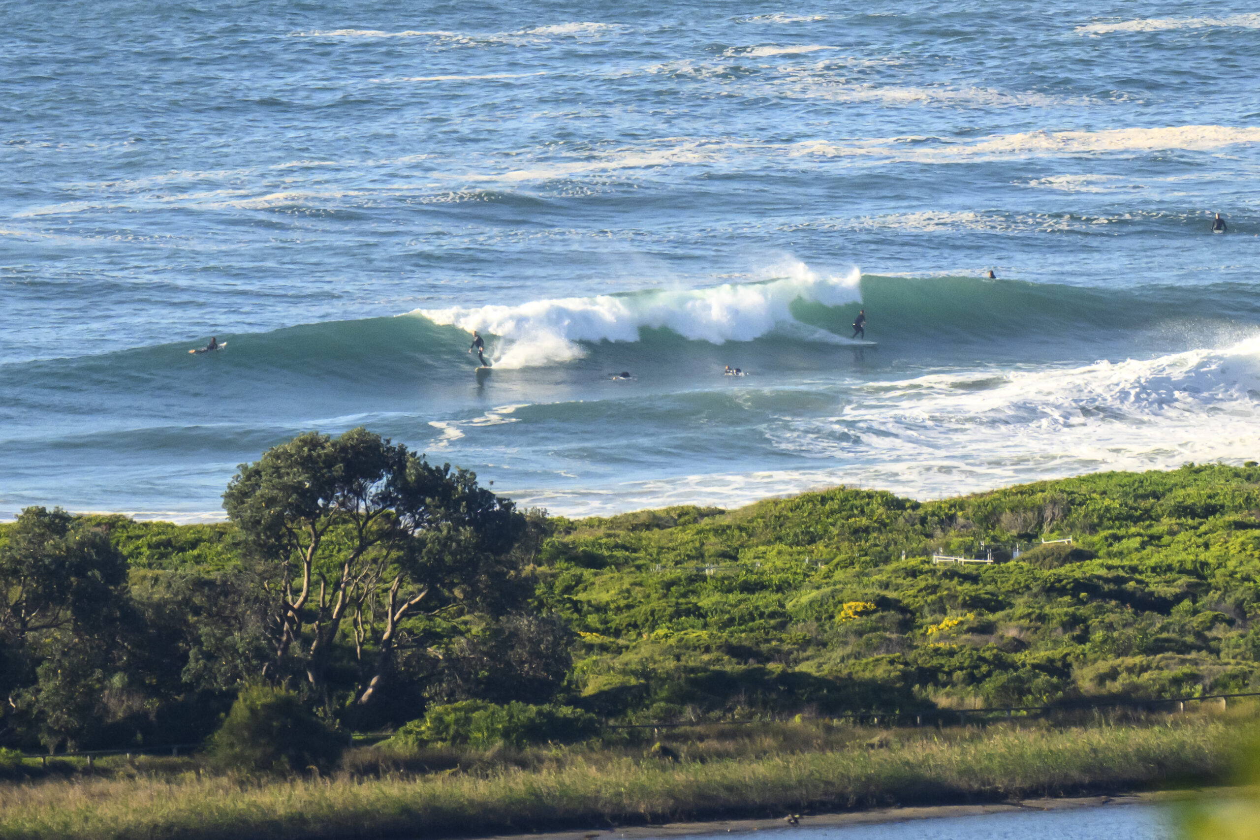
Surf forecast issued Thursday 4 January 2018: Seven day outlook for Sydney:
There were some rideable waves in the lower reaches of the 1-2 metre range this morning for keen punters at some places open to pretty much dead South as a result of the strong SSE wind we had over the past couple of days, before the tide got into it. Boy that’s a long sentence for you to get stuck into if you want. Lower reaches ??? He’s talking in riddles.
But they’ve already eased back. See… Shorter sentences make more sense and are easier to read. But I don’t have time to rewrite it more nicer.
What’s that you say?? …Just get on with it???
Quick summary for you… Small waves. Possibly some mal rides at the right tides, right places. Keep your eyes open for opportunities. Enjoy the warm water and warmer weather. Watch the extreme UVs, plus a couple of days when the Bureau says there might be Tstorms, and take precautions. Stay cool. And keep smiling. (I know they aren’t sentences… Just consider them to be bullet points to start preparing you for the working and study world soon). Keep smiling I said!
Friday: maybe around 1 metre or so or less at places open to dead South
Saturday: ditto
Sunday: around 1 metre or so of North East windswell
Monday: ditto
Tuesday: ditto but a little bit bigger
Wednesday: about the same as Tuesday, maybe a touch more
Thursday: about 1 metre or so North East
In the Sky


Winds
https://www.windyty.com/
In the Sea
Water temp is around 22,23… nice
Lots of nice warm water up and down the East Coast, from Byron 26 to Eden 22.

Tides
http://www.rms.nsw.gov.au/documents/maritime/usingwaterways/tides-weather/tide-tables-2017-2018.pdf
The king tides (Highs over 2 metres) we’ve had over the past few days will gradually start to ease back. But they will still be high Highs and low Lows (say that quickly) for a while.
Weather from the Bureau:
Forecast for the rest of Thursday
- Summary

- Max 25
- Cloudy.
- Chance of any rain: 20%

Sydney area
Cloudy. Medium (50%) chance of showers in the morning and early afternoon. Light winds.
Fire Danger – High
Sun protection recommended from 8:40 am to 5:10 pm, UV Index predicted to reach 13 [Extreme]
7 day Town Forecasts
| Precis Icon | Location | Min | Max |
|---|---|---|---|
| Sydney | – | 25 | |
| Penrith | – | 31 | |
| Liverpool | – | 29 | |
| Terrey Hills | – | 25 | |
| Richmond | – | 31 | |
| Parramatta | – | 28 | |
| Campbelltown | – | 29 | |
| Bondi | – | 22 |
Friday 5 January
- Summary

- Min 18
- Max 28
- Sunny.
- Chance of any rain: 0%

Sydney area
Sunny. Light winds becoming east to northeasterly 15 to 25 km/h in the middle of the day then becoming light in the late evening.
Sun protection recommended from 8:40 am to 5:10 pm, UV Index predicted to reach 13 [Extreme]
Saturday 6 January
- Summary

- Min 20
- Max 31
- Mostly sunny.
- Chance of any rain: 0%

Sydney area
Hot and mostly sunny. Light winds becoming northeasterly 25 to 35 km/h during the day.
Sun protection recommended from 8:30 am to 5:10 pm, UV Index predicted to reach 14 [Extreme]
Sunday 7 January
- Summary

- Min 23
- Max 37
- Hot and mostly sunny.
- Chance of any rain: 20%

Sydney area
Very hot and mostly sunny. Slight (20%) chance of a shower. Light winds becoming west to northwesterly 15 to 20 km/h during the morning then shifting south to southeasterly 25 to 35 km/h during the day.
Sun protection recommended from 8:30 am to 5:10 pm, UV Index predicted to reach 13 [Extreme]
Monday 8 January
- Summary

- Min 21
- Max 33
- Shower or two.
- Possible rainfall: 1 to 5 mm
- Chance of any rain: 70%

Sydney area
Hot. Cloudy. High (70%) chance of showers, most likely later in the day. Winds south to southwesterly 15 to 25 km/h tending northwest to northeasterly 15 to 20 km/h during the morning.
Tuesday 9 January
- Summary

- Min 21
- Max 24
- Showers.
- Possible rainfall: 2 to 6 mm
- Chance of any rain: 80%

Sydney area
Cloudy. High (80%) chance of showers. The chance of a thunderstorm. Winds northeasterly 15 to 20 km/h shifting south to southeasterly 20 to 30 km/h during the morning.
Wednesday 10 January
- Summary

- Min 21
- Max 26
- Showers.
- Possible rainfall: 3 to 10 mm
- Chance of any rain: 80%

Sydney area
Cloudy. High (80%) chance of showers. The chance of a thunderstorm. Light winds becoming east to northeasterly 15 to 20 km/h during the day.

