
Hello Friends,
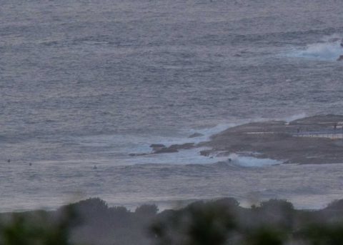
After peaking late yesterday evening at around the 2 metre mark out at sea, this morning sees it dropping back to 1.7 m at 12 sec from the south and NE. Surface conditions were relatively smooth early thanks to a light easterly breeze. It should go SE later and pick up into the 10-15 kts by noon. Tide was low at 0500 and is coming into a 1.67 m high at 1125.
There were three or four people in the water at the point when I grabbed the snaps. It looked to be in the waist high range with the odd chest-ish sets. But the NE component of the swell was quite episodic yesterday so I imagine it’s the same today and in fact the Bureau has posted a warning for large and powerful surf conditions. If you’re a beginner, you really need to watch the conditions for awhile before diving in at a magnet spot.
The latest modelling from the Bureau shows the NE swell building across the next 24 hours. Unfortunately the wind is going to pick up from the SE this afternoon and by tomorrow morning it’ll be belting along at 20-25 kts. So not the best outlook for surfin’. And it could be Thursday before the wind starts to relent.
Go well with you adventures today and yep, I’m likely to post a few more pics later, so maybe check back from time to time.
Weather Situation
A high pressure system is centred south of the Bight, while a broad area of low pressure lies over inland New South Wales. Tropical Cyclone Gita lies over the northern central Tasman Sea. The high is expected to move to the south of Tasmania today and to the southern Tasman Sea on Tuesday. The cyclone is expected to pass to the east of Lord Howe Island today then to turn southeast towards New Zealand. Between the two systems a fresh to strong southeasterly airstream will develop on the New South Wales coast today then should gradually ease over the following days.
Forecast for Monday until midnight
Strong Wind Warning for Monday for Sydney Coast
- Winds
- Easterly about 10 knots tending southeasterly 10 to 15 knots in the middle of the day then increasing to 15 to 25 knots in the late afternoon. Winds reaching up to 30 knots in the late evening.
- Seas
- Below 1 metre, increasing to 1 to 1.5 metres during the afternoon.
- Swell
- Northeasterly 2 to 2.5 metres.
- Weather
- Partly cloudy. 60% chance of showers.
- Caution
- Large and powerful surf conditions are expected to be hazardous for coastal activities such as crossing bars by boat and rock fishing.
Tuesday 20 February
Strong Wind Warning for Tuesday for Sydney Coast
- Winds
- Southeasterly 20 to 25 knots, reaching up to 30 knots early in the morning.
- Seas
- 1.5 to 2.5 metres, decreasing to 1.5 metres during the afternoon.
- 1st Swell
- Easterly 1.5 to 2.5 metres during the morning.
- 2nd Swell
- Southerly around 1 metre, increasing to 1 to 2 metres during the morning.
- Weather
- Cloudy. 70% chance of showers.
- Caution
- Large and powerful surf conditions are expected to be hazardous for coastal activities such as crossing bars by boat and rock fishing.
Wednesday 21 February
- Winds
- Southerly 10 to 15 knots turning east to southeasterly during the morning.
- Seas
- 1 to 1.5 metres, decreasing below 1 metre during the morning.
- 1st Swell
- Southeasterly 2 to 2.5 metres.
- 2nd Swell
- Southerly around 1 metre inshore, increasing to 1 to 1.5 metres offshore.
- Weather
- Cloudy.
