
Hello Friends,
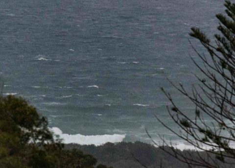
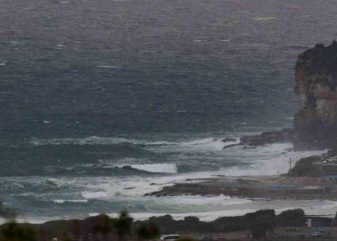
No reason to take the board to DY this morning. The pictures tell the story of the belting SE wind and 3.6 metre 9-sec SSE swell. The Bureau says we’ll have rain through Saturday and SE wind through to Friday morning. So, I’m not too hopeful of decent surf anywhere until maybe north corners on Friday arvo…
Have a top old day everybody!
Weather Situation
A trough lies about central parts of the coast as a very strong high pressure system south of Tasmania slowly moves eastward. This is generating fresh east to southeasterly winds along the New South Wales coast, with particularly strong winds on the southern flank of the trough. As the high slips further to the southeast on Friday and the trough weakens, winds will tend northeasterly.
Forecast for Wednesday until midnight
Gale Warning for Wednesday for Sydney Coast
Winds
Southeasterly 25 to 30 knots, reaching up to 35 knots offshore during the morning.
Seas
2.5 to 3 metres, increasing to 2.5 to 4 metres offshore.
1st Swell
Southerly 1.5 to 2 metres.
2nd Swell
Easterly 1 to 2 metres, increasing to 1.5 to 2.5 metres during the day.
Weather
Cloudy. Near 100% chance of rain. Rain and showers heavy at times offshore. The chance of a thunderstorm offshore.
Thursday 22 March
Strong Wind Warning for Thursday for Sydney Coast
Winds
Southeasterly 20 to 25 knots, reaching up to 30 knots offshore early in the morning.
Seas
2 to 3 metres.
1st Swell
Easterly 1.5 to 2.5 metres.
2nd Swell
Southerly 1 to 2 metres, decreasing to around 1 metre during the morning.
Weather
Cloudy. 95% chance of showers.
Friday 23 March
Winds
East to southeasterly 20 to 25 knots tending east to northeasterly 10 to 15 knots during the day.
Seas
1.5 to 2.5 metres, decreasing to 1 to 1.5 metres during the morning.
Swell
Easterly 2 to 3 metres.
Weather
Cloudy. 90% chance of showers.

