
Hello Friends,
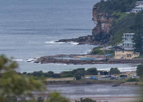
20-25 kts of WSW wind meant surface conditions were pretty clean at Dee Why. Unfortunately the swell is
only 7 seconds apart, so although it’s 2 metres or so out at sea and coming from the south, the wind is holding it offshore. Eden buoy was picking up 3 metres of dead south swell this morning and the Bureau tells us we can expect the energy to get here by this evening. The wind is going to belt along at 30-40 kts from the w to sw, and there’s a high likelihood of rain, but given the forecast, I reckon there could be some surfable stuff in the protected corners soon. I’ll keep an eye on it and if possible will update.
Tide was low at 0610 and will be back to a 1.45 m high at 1220.
Outlook is for the wind to be straight south by tomorrow and to stay that way through to Thursday. The models have the swell peaking tonight and then gradually decreasing across the coming week. The good news – apart from the wind – is that waves should stay in the surfable range into the weekend.
Have yourself a good Monday everyone!
Weather Situation
A complex low pressure system in the southern Tasman Sea will slowly move east over the coming days. A south to southwesterly change will move up the coast from the south and strengthen on Monday. By the middle of the week, winds are expected to ease as the low moves closer to New Zealand. A high centred south of the Bight will move to the southern Tasman Sea on Tuesday and persist for the remainder of the week.
Forecast for Monday until midnight
Gale Warning for Monday for Sydney Coast
Winds
West to southwesterly 30 to 35 knots tending south to southwesterly 30 to 40 knots early in the morning.
Seas
3 to 4 metres.
Swell
Southerly 2 to 3 metres, increasing to 3 to 4 metres by early evening.
Weather
Cloudy. 95% chance of showers. Showers heavy at times offshore. The chance of a thunderstorm offshore.
Caution
Large and powerful surf conditions in the evening are expected to be hazardous for coastal activities such as crossing bars by boat and rock fishing.
Tuesday 19 June
Gale Warning for Tuesday for Sydney Coast
Winds
Southerly 20 to 30 knots, reaching up to 35 knots early in the morning.
Seas
3 to 4 metres, decreasing to 2 to 3 metres around midday.
Swell
Southerly 3 to 4 metres, decreasing to 3 metres during the afternoon.
Weather
Cloudy. 95% chance of showers. The chance of a thunderstorm.
Caution
Large and powerful surf conditions are expected to be hazardous for coastal activities such as crossing bars by boat and rock fishing.
Wednesday 20 June
Winds
Southerly 15 to 25 knots decreasing to about 10 knots during the evening.
Seas
1.5 to 2.5 metres, decreasing to 1 to 1.5 metres during the afternoon or evening.
Swell
Southeasterly 2.5 to 3 metres.
Weather
Partly cloudy. 70% chance of showers.

