
Hello Friends,
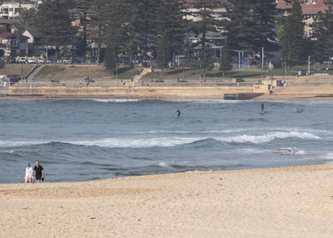
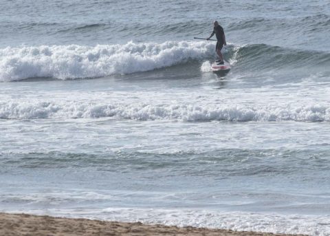
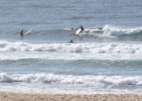
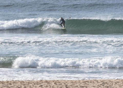
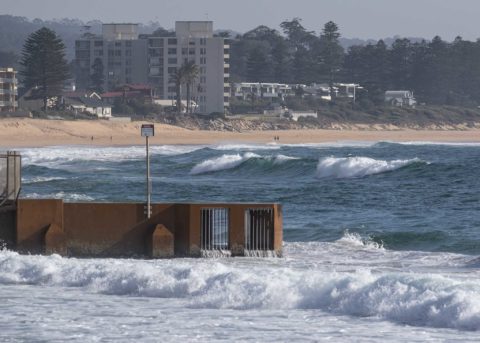
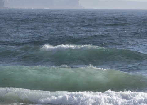
Back from my adventures talking to pollies in Canberra about climate bipartisanship (hey, one can dream). Surf situation has not improved in my absence. Stopped by Collaroy for a look and then wandered past Long Reef before heading back to the RealSurf wheelhouse to check in. As the pictures show, there are only soft little windswell bumps coming in from the NE. Collaroy had no takers, although I think if you were really keen, you could have a splash with a bodyboard maybe. Definitely more activity around the corner at Longy where a dozen or so folks were picking up very soft and slow waist high bumps just north of the lugga. There were a few more down at Kiddies, but they didn’t seem to be finding much.
To put some numbers on the situation, as of 0600, the MHL buoy was seeing about 7-sec, 2 metre bump from 60° (NE). As of 0720, North Head was detecting 5-7 kts from the north. Tide was dropping to the 0.7 low at 0940. By the time the it’s back to the 1.4 m high at 1620, the southerly could be with us.
Tomorrow’s shaping to be southerly and – unlike today – cloudy. Swell could come up a little, but the models show periods in the windswell range, so I’m not expecting much of interest in spots out of the wind. That said, the Bureau predicts a mix of swell, including some bump out of the NE. We could have more favourable winds for Friday morning, but the swell settings are not encouraging. I’m hoping for some mal-able bumps.
Have a top old Wednesday!
Weather Situation
A high pressure system over the Tasman Sea is slowly moving east as a cold front approaches the coast from the west. Fresh to strong northerly winds will continue over the New South Wales coast ahead of the front. A southerly change is forecast with the passage of the front today up to the Mid North Coast and early Thursday in the far north. Winds will then gradually shift northerly on Friday or Saturday ahead of the next front.
Forecast for Wednesday until midnight
- Winds
- Northerly 15 to 25 knots shifting southerly in the late afternoon.
- Seas
- 1.5 to 2.5 metres, decreasing below 1.5 metres during the afternoon, then increasing to 1.5 to 2 metres later in the evening.
- Swell
- Northeasterly around 1 metre inshore, increasing to 1 to 1.5 metres offshore.
- Weather
- Mostly sunny.
Thursday 20 September
- Winds
- Southerly 15 to 20 knots.
- Seas
- 1 to 2 metres.
- 1st Swell
- Southerly below 1 metre, increasing to 1 to 1.5 metres during the morning.
- 2nd Swell
- Northeasterly around 1 metre.
- Weather
- Cloudy. 70% chance of showers in the morning and afternoon. The chance of a thunderstorm in the late morning and afternoon.
Friday 21 September
- Winds
- South to southwesterly 10 to 15 knots shifting north to northeasterly below 10 knots during the evening.
- Seas
- Around 1 metre.
- Swell
- Southerly around 1 metre inshore, increasing to 1 to 1.5 metres offshore.
- Weather
- Mostly sunny.

